File:Wfm lewis landsat.jpg

本预览的尺寸:444 × 599像素。 其他分辨率:178 × 240像素 | 355 × 480像素 | 948 × 1,280像素。
原始文件 (948 × 1,280像素,文件大小:137 KB,MIME类型:image/jpeg)
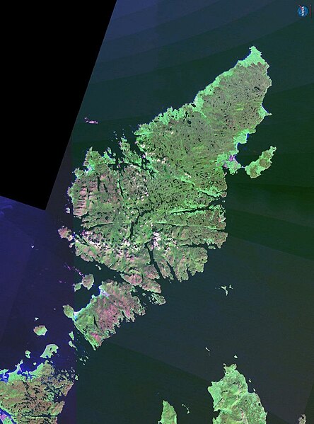
The Isle of Lewis in Scotland.
NASA Landsat 7 image. Final image made using NASA World Wind.
| 本图像属于 w:公有领域 ,因其为 NASA 的 World Wind 卫星地图浏览器的一张截图,且使用了公有领域图层,如 Blue Marble、MODIS、Landsat、SRTM、USGS、GLOBE 等。
|
 |
文件历史
点击某个日期/时间查看对应时刻的文件。
| 日期/时间 | 缩略图 | 大小 | 用户 | 备注 | |
|---|---|---|---|---|---|
| 当前 | 2006年10月21日 (六) 18:02 | | 948 × 1,280(137 KB) | Finlay McWalter | The Isle of Lewis in Scotland. NASA Landsat 7 image. Final image made using NASA World Wind. {{PD-WorldWind}} category:Scotland |
文件用途
以下页面使用本文件:
全域文件用途
以下其他wiki使用此文件:
- br.wikipedia.org上的用途
- ceb.wikipedia.org上的用途
- cs.wikipedia.org上的用途
- cy.wikipedia.org上的用途
- de.wikipedia.org上的用途
- el.wikipedia.org上的用途
- en.wikipedia.org上的用途
- en.wikinews.org上的用途
- eu.wikipedia.org上的用途
- fr.wikipedia.org上的用途
- gd.wikipedia.org上的用途
- gl.wikipedia.org上的用途
- it.wikipedia.org上的用途
- la.wikipedia.org上的用途
- nn.wikipedia.org上的用途
- no.wikipedia.org上的用途
- pl.wikipedia.org上的用途
- pnb.wikipedia.org上的用途
- pt.wikipedia.org上的用途
- sco.wikipedia.org上的用途
- sh.wikipedia.org上的用途
- sk.wikipedia.org上的用途
- sr.wikipedia.org上的用途
- sv.wikipedia.org上的用途
- uk.wikipedia.org上的用途