File:CapeCodCanalEastEndAerial.jpg
此为最大尺寸。
CapeCodCanalEastEndAerial.jpg (270 × 365像素,文件大小:16 KB,MIME类型:image/jpeg)
摘要
| 描述 |
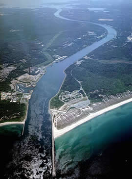
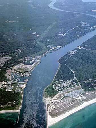
English: Aerial photo of the East End of the Cape Cod Canal and Scusset Beach State Reservation in southeastern Massachusetts, USA. |
| 来源 | http://www.nae.usace.army.mil/recreati/ccc/recreation/recreation.htm |
| 作者 | U.S. Army Corps of Engineers |
| 其他版本 | http://www.nae.usace.army.mil/Portals/74/siteimages/Recreation/CCC/Web-site-photos/010827-A-KF207-001.JPG?ver=2016-12-22-133017-940 |
| 相机位置 | | 在以下服务上查看本图像和附近其他图像: OpenStreetMap |
|---|
许可协议
|
|
 |
文件历史
点击某个日期/时间查看对应时刻的文件。
| 日期/时间 | 缩略图 | 大小 | 用户 | 备注 | |
|---|---|---|---|---|---|
| 当前 | 2009年10月31日 (六) 15:31 | | 270 × 365(16 KB) | OldPine | {{Information |Description={{en|1=Aerial photo of the East End of the Cape Cod Canal and Scusset Beach State Reservation in southeastern Massachusetts, USA.}} |Source=http://www.nae.usace.army.mil/recreati/ccc/recreation/recreation.htm |Author=U.S. Army C |
文件用途
以下页面使用本文件:
全域文件用途
以下其他wiki使用此文件:
- ar.wikipedia.org上的用途
- en.wikipedia.org上的用途
- en.wikivoyage.org上的用途
- it.wikipedia.org上的用途
- ja.wikipedia.org上的用途
- nn.wikipedia.org上的用途
- pt.wikipedia.org上的用途
- www.wikidata.org上的用途