File:Ancient Orient.png

本预览的尺寸:800 × 516像素。 其他分辨率:320 × 206像素 | 640 × 413像素 | 1,024 × 661像素 | 1,280 × 826像素 | 2,560 × 1,652像素 | 4,365 × 2,816像素。
原始文件 (4,365 × 2,816像素,文件大小:10.18 MB,MIME类型:image/png)
摘要
| 描述 |
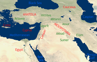
English: See Image:Orient 27 43 22 55 blank map.png for a blank map.
self-created in November 2004 on the basis of the 2002 NASA Blue Marble image.[1] |
| 日期 | 2004年11月15日 (原始上传日期) |
| 来源 | This compound image uses free material land_shallow_topo_east.tif from NASA Visible Earth (formerly "Blue Marble") and world.200407.3x21600x21600.C1.png from JULY, BLUE MARBLE NEXT GENERATION |
| 作者 | Dbachmann and Cush at en.wikipedia |
许可协议
For the current map
| 本作品已被作者Cush释出到公有领域。这适用于全世界。 在一些国家这可能不合法;如果是这样的话,那么: |
For the previous map
| 本作品已被作者英语维基百科的Dbachmann释出到公有领域。这适用于全世界。 在一些国家这可能不合法;如果是这样的话,那么: Dbachmann无条件地授予任何人以任何目的使用本作品的权利,除非这些条件是法律规定所必需的。 |
原始上传日志
原始描述頁面位於這裡。下列使用者名稱均來自en.wikipedia。
- 2004-11-15 08:40 Dbachmann 429×274×8 (213130 bytes) {{PD}}
文件历史
点击某个日期/时间查看对应时刻的文件。
| 日期/时间 | 缩略图 | 大小 | 用户 | 备注 | |
|---|---|---|---|---|---|
| 当前 | 2010年10月22日 (五) 13:34 | | 4,365 × 2,816(10.18 MB) | Cush | Enhanced and enlarged version with city names and locations. Unfortunately the map had to be scaled to 88% of the original (due to size constraints on WP) so that the city labels are a little blurred. |
| 2010年10月22日 (五) 13:25 |  | 429 × 274(208 KB) | Cush | restored previous version, grrr | |
| 2010年10月22日 (五) 13:19 |  | 4,960 × 3,200(12.11 MB) | Cush | Enhanced and enlarged version with city names and locations | |
| 2008年7月25日 (五) 01:25 |  | 429 × 274(208 KB) | File Upload Bot (Magnus Manske) | {{BotMoveToCommons|en.wikipedia}} {{Information |Description={{en|see en::Image:Orient 27 43 22 55 blank map.png for a blank map. self-created in November 2004 on the basis of the 2002 NASA en:Blue Marble image.[http://earthobservatory.nasa. |
文件用途
全域文件用途
以下其他wiki使用此文件:
- af.wikipedia.org上的用途
- am.wikipedia.org上的用途
- ar.wikipedia.org上的用途
- arz.wikipedia.org上的用途
- be-tarask.wikipedia.org上的用途
- be.wikipedia.org上的用途
- bn.wikipedia.org上的用途
- ca.wikipedia.org上的用途
- cs.wikipedia.org上的用途
- en.wikipedia.org上的用途
- Talk:Arabic
- Talk:Delian League
- Talk:Adamic language
- Talk:Alyattes of Lydia
- Talk:Bible
- Talk:Biblical canon
- Talk:Books of the Bible
- Talk:Behistun Inscription
- Talk:Battle of Marathon
- Talk:Cassandra
- Talk:Antisemitism in Christianity
- Talk:Dragon
- Talk:Epistle of James
- Talk:Book of Genesis
- Talk:Hebrew alphabet
- Talk:History of ancient Israel and Judah
- Talk:Religion in pre-Islamic Arabia
- Talk:Jerusalem
- Talk:Japheth
- Talk:Lucifer
- Talk:New Testament
- Talk:Old Testament
- Talk:Roman Empire
- Talk:Resurrection of Jesus
- Talk:Satan
- Talk:Temple in Jerusalem
- Talk:Names of God in Judaism
- Talk:Great Tribulation
- Talk:Matthias the Apostle
- Talk:Acre, Israel
- Talk:Nevi'im
- Talk:Cambyses II
- Talk:Gospel of Luke
- Talk:Tantalus
- Talk:Semitic languages
- Talk:Kingdom of Kush
- Talk:Zoroastrianism
- Talk:Babylonia and Assyria
- Talk:History of the ancient Levant
- Talk:Judas Iscariot
查看本文件的更多全域用途。