File:Territorial-acquisition-uscensus-bureau.jpg
預覽大小:756 × 599 像素。 其他解析度:303 × 240 像素 | 606 × 480 像素 | 969 × 768 像素 | 1,280 × 1,015 像素 | 1,409 × 1,117 像素。
原始檔案 (1,409 × 1,117 像素,檔案大小:333 KB,MIME 類型:image/jpeg)

|
本圖片是以PNG、GIF或JPEG格式上傳。然而,其中包含的資料或訊息,應該重新建立成可縮放向量圖形(SVG)檔案,以更有效率或更準確的方式儲存。如有可能,請上傳本圖片的SVG格式版本。在上傳之後,請修改維基各姊妹計畫中所有使用舊版圖片的條目(列在圖像連結章節中),替換為新版圖片,並在舊圖片的描述頁中加入{{Vector version available|新圖片名稱.svg}}模板,同時移除本模板。
|


摘要
| 描述 |
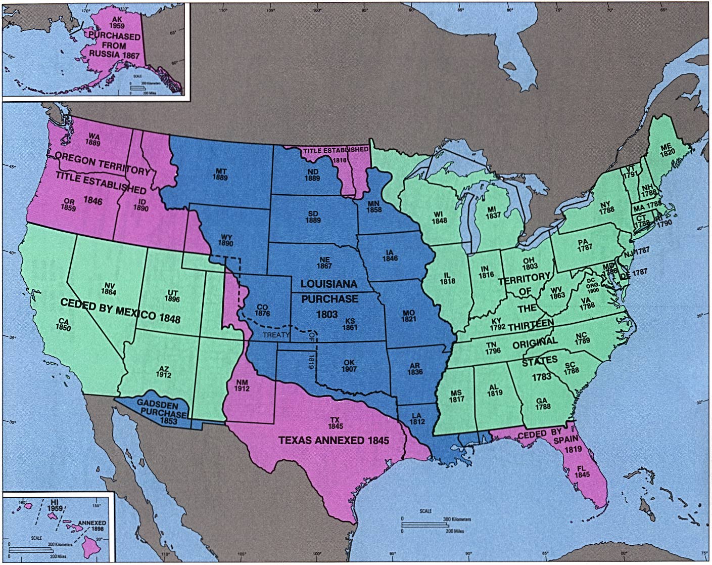
English: perry-castenada: Admission of States and Territorial Acquisition U.S. Bureau of the Census (341K) http://www.lib.utexas.edu/maps/histus.html |
| 來源 | US gov |
| 作者 | US gov |
授權條款
This image or file is a work of a United States Census Bureau employee, taken or made as part of that person's official duties. As a work of the U.S. federal government, the image is in the public domain.
|
 |
原始上傳日誌
The original description page was here. All following user names refer to en.wikipedia.
- 2004-09-30 02:05 Jengod 1409×1117×8 (341419 bytes) perry-castenada: Admission of States and Territorial Acquistion U.S. Bureau of the Census (341K) http://www.lib.utexas.edu/maps/histus.html
檔案歷史
點選日期/時間以檢視該時間的檔案版本。
| 日期/時間 | 縮圖 | 尺寸 | 使用者 | 備註 | |
|---|---|---|---|---|---|
| 目前 | 2008年4月18日 (五) 05:43 | | 1,409 × 1,117(333 KB) | Urdangaray | {{Information |Description={{en|perry-castenada: Admission of States and Territorial Acquisition U.S. Bureau of the Census (341K) http://www.lib.utexas.edu/maps/histus.html en:Category:Historical maps of the United States}} |Source=Transferred fro |
檔案用途
下列頁面有用到此檔案:
全域檔案使用狀況
以下其他 wiki 使用了這個檔案:
- ar.wikipedia.org 的使用狀況
- bn.wikipedia.org 的使用狀況
- da.wikipedia.org 的使用狀況
- de.wikipedia.org 的使用狀況
- en.wikipedia.org 的使用狀況
- en.wikivoyage.org 的使用狀況
- es.wikipedia.org 的使用狀況
- eu.wikipedia.org 的使用狀況
- fa.wikipedia.org 的使用狀況
- it.wikipedia.org 的使用狀況
- ms.wikipedia.org 的使用狀況
- pt.wikipedia.org 的使用狀況
- ro.wikipedia.org 的使用狀況
- sr.wikipedia.org 的使用狀況
- sv.wikipedia.org 的使用狀況
- vi.wikipedia.org 的使用狀況