File:Pacific typhoon tracks 1980-2005.jpg
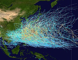
預覽大小:783 × 600 像素。 其他解析度:313 × 240 像素 | 627 × 480 像素 | 1,003 × 768 像素 | 1,280 × 980 像素 | 2,560 × 1,961 像素 | 4,700 × 3,600 像素。
原始檔案 (4,700 × 3,600 像素,檔案大小:4.04 MB,MIME 類型:image/jpeg)
| 描述 |
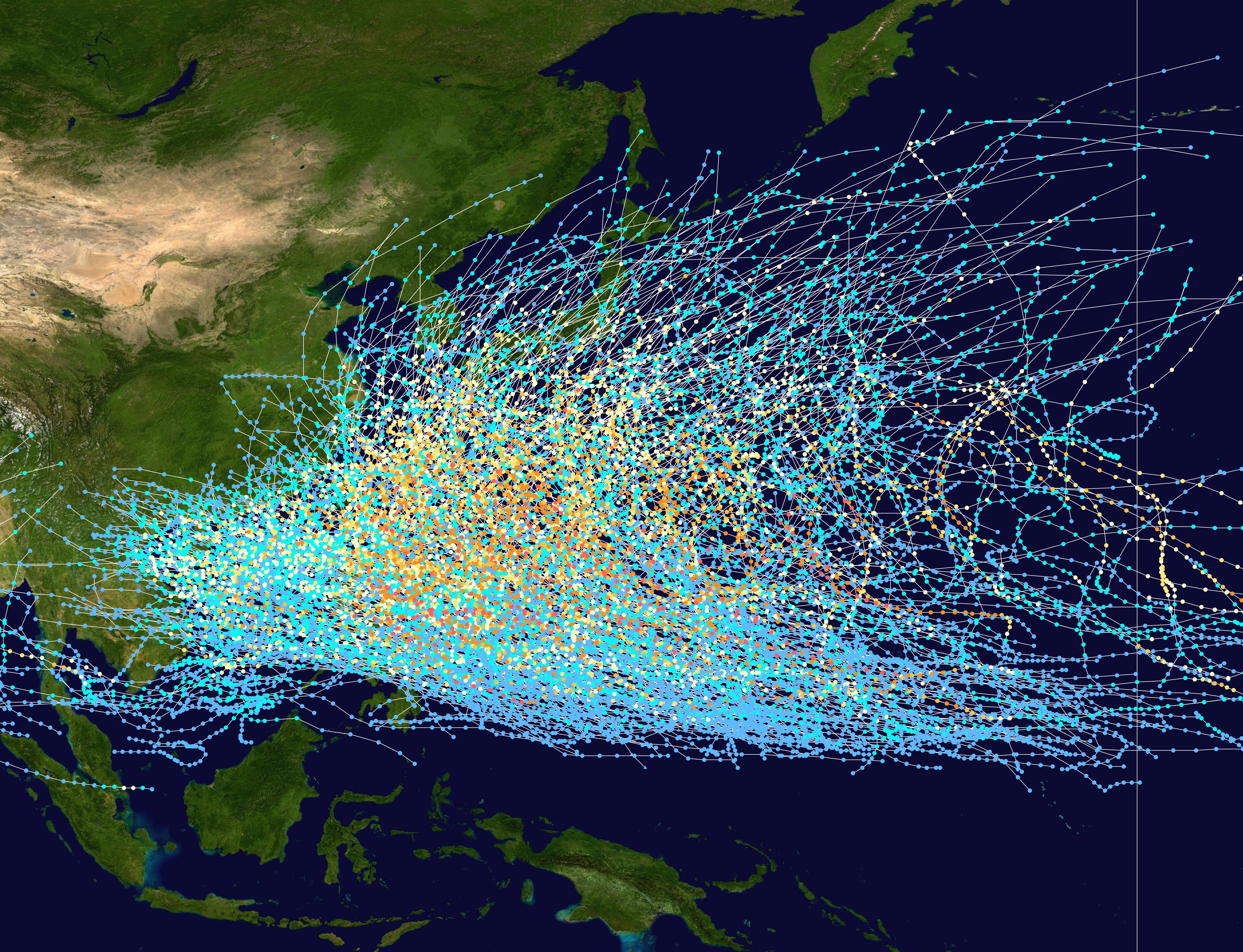
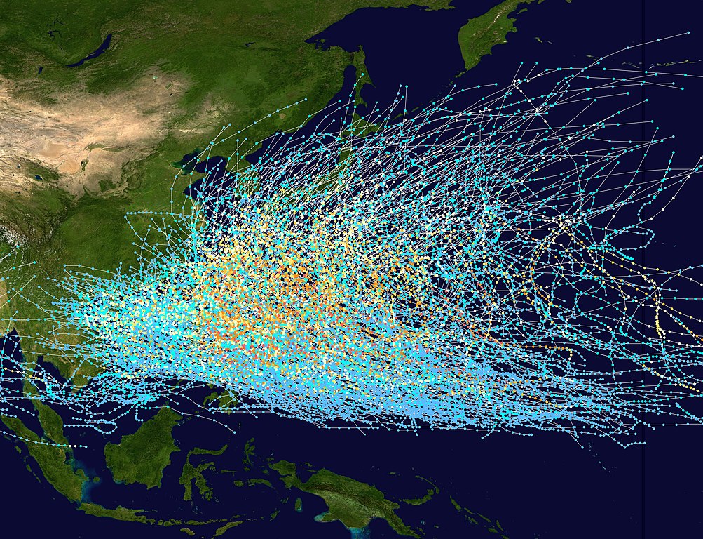
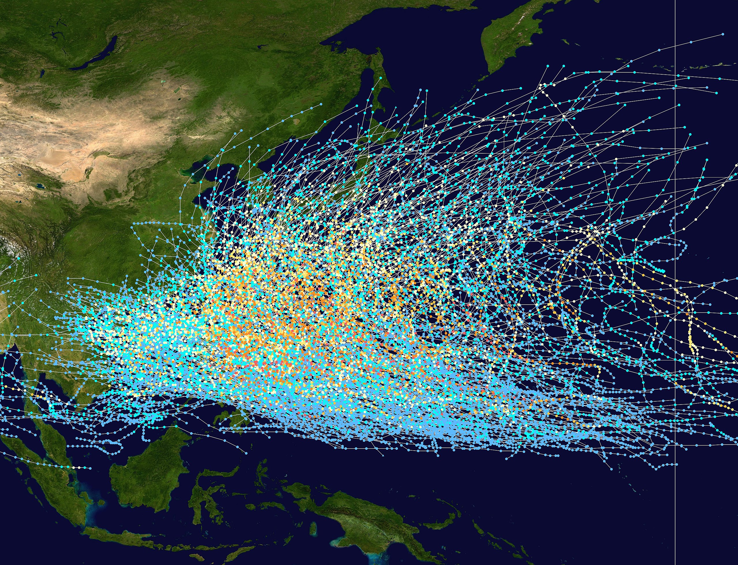
English: This trackmap shows the tracks of all tropical cyclones in the Northwest Pacific Ocean from 1980 to 2005. The International Date Line is marked on the map, this is the eastern boundary of the basin.. The points show the location of each storm at 6-hour intervals. The colour represents the storm's maximum sustained wind speeds as classified in the Saffir-Simpson Hurricane Scale (see below), and the shape of the data points represent the nature of the storm.
Tropical depression (≤38 mph, ≤62 km/h)
Tropical storm (39–73 mph, 63–118 km/h)
Category 1 (74–95 mph, 119–153 km/h)
Category 2 (96–110 mph, 154–177 km/h)
Category 3 (111–129 mph, 178–208 km/h)
Category 4 (130–156 mph, 209–251 km/h)
Category 5 (≥157 mph, ≥252 km/h)
Unknown
Storm type |
| 日期 | 1980–2005 |
| 來源 | Created using Wikipedia:WikiProject Tropical cyclones/Tracks. The background image is from NASA [1]. The tracking data is from the Joint Typhoon Warning Center's best track database |
| 作者 | Nilfanion |
Licensing:
| 此作品已由其作者,Nilfanion,釋出至公有領域。此授權條款在全世界均適用。 這可能在某些國家不合法,如果是的話: Nilfanion授予任何人有權利使用此作品於任何用途,除受法律約束外,不受任何限制。 |
檔案歷史
點選日期/時間以檢視該時間的檔案版本。
| 日期/時間 | 縮圖 | 尺寸 | 使用者 | 備註 | |
|---|---|---|---|---|---|
| 目前 | 2007年2月27日 (二) 21:21 | | 4,700 × 3,600(4.04 MB) | Nilfanion | {|Description={|align="{{{align|right}}}" border="0" cellspacing="0" cellpadding="0" style="background:transparent;text-align:center" |- |colspan="7" nowrap="nowrap"| <small>Saffir-Simpson Hurricane Scale</small> |- |s |
檔案用途
全域檔案使用狀況
以下其他 wiki 使用了這個檔案:
- az.wikipedia.org 的使用狀況
- be-tarask.wikipedia.org 的使用狀況
- be.wikipedia.org 的使用狀況
- de.wikipedia.org 的使用狀況
- en.wikipedia.org 的使用狀況
- fr.wikipedia.org 的使用狀況
- hak.wikipedia.org 的使用狀況
- hy.wikipedia.org 的使用狀況
- ja.wikipedia.org 的使用狀況
- ka.wikipedia.org 的使用狀況
- kk.wikipedia.org 的使用狀況
- krc.wikipedia.org 的使用狀況
- lez.wikipedia.org 的使用狀況
- ms.wikipedia.org 的使用狀況
- pt.wikipedia.org 的使用狀況
- ru.wikipedia.org 的使用狀況
- th.wikipedia.org 的使用狀況
- tl.wikipedia.org 的使用狀況
- tyv.wikipedia.org 的使用狀況
- uk.wikipedia.org 的使用狀況
- uz.wikipedia.org 的使用狀況
- vi.wikipedia.org 的使用狀況