File:Map of Amr's Conquests.png
預覽大小:800 × 506 像素。 其他解析度:320 × 202 像素 | 640 × 404 像素 | 1,024 × 647 像素 | 1,280 × 809 像素 | 2,560 × 1,618 像素 | 7,025 × 4,439 像素。
原始檔案 (7,025 × 4,439 像素,檔案大小:75.62 MB,MIME 類型:image/png)
摘要
| 描述 |
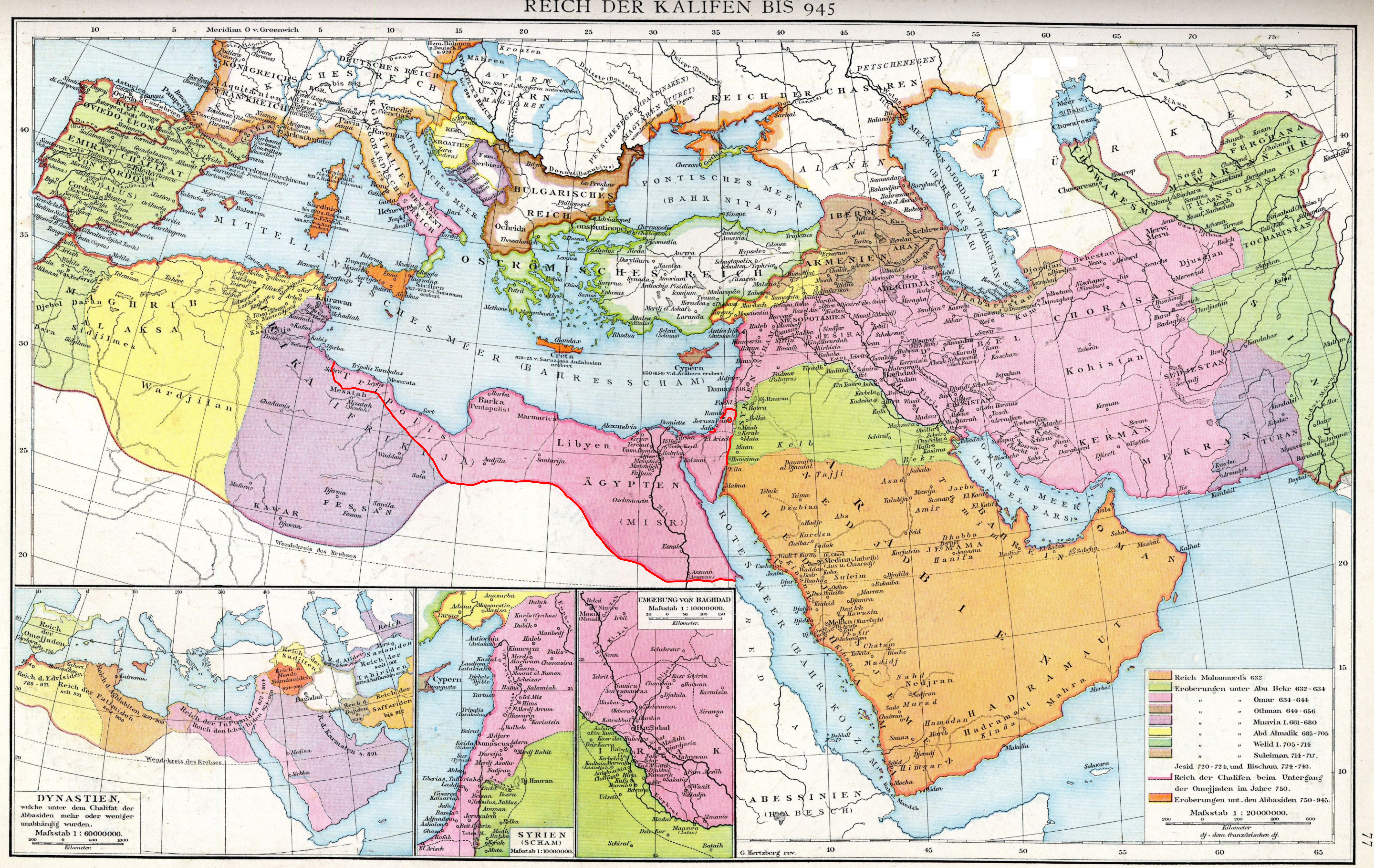
English: The empire of the Caliphs to 945. Map of the Historical Atlas of Gustav Droysen, 1886.
|
| 日期 | (Red-line edit done by uploader on 23 September 2019 |
| 來源 | Gustav Droysens Allgemeiner historischer Handatlas in 96 Karten mit erläuterndem Text Bielefeld [u.a.]: Velhagen & Klasing 1886, S. 77. |
| 作者 | Johann Gustav Droysen (6 July 1808 – 19 June 1884) |
授權條款
|
本作品在其來源國以及其他著作權期限是作者逝世後100年或以下的國家與地區屬於公有領域。 | |
| 此作品無已知的著作權限制,亦不受所有相關和鄰接的權利限制。 | |
檔案歷史
點選日期/時間以檢視該時間的檔案版本。
| 日期/時間 | 縮圖 | 尺寸 | 使用者 | 備註 | |
|---|---|---|---|---|---|
| 目前 | 2019年9月23日 (一) 20:57 | | 7,025 × 4,439(75.62 MB) | Al Ameer son | User created page with UploadWizard |
檔案用途
下列頁面有用到此檔案:
全域檔案使用狀況
以下其他 wiki 使用了這個檔案:
- en.wikipedia.org 的使用狀況