File:Lake sakakawea.jpg
預覽大小:607 × 600 像素。 其他解析度:243 × 240 像素 | 486 × 480 像素 | 778 × 768 像素 | 1,037 × 1,024 像素 | 2,073 × 2,048 像素 | 3,904 × 3,856 像素。
原始檔案 (3,904 × 3,856 像素,檔案大小:6.91 MB,MIME 類型:image/jpeg)
摘要
| 描述 |
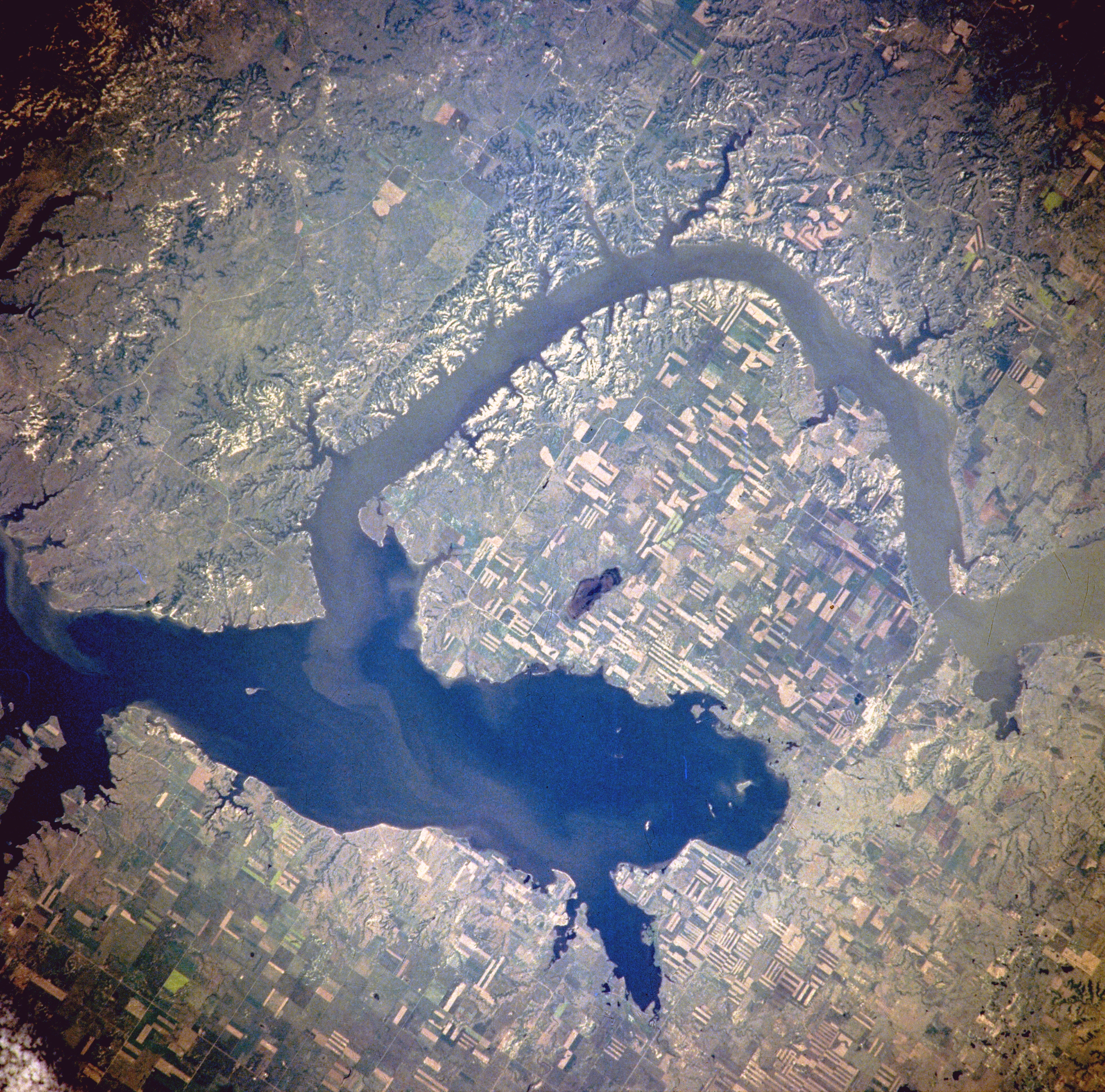
Van Hook Arm of Lake Sakakawea, North Dakota, United States - Satellite image, July 1996 The image description can be found here. The bridge on the right holds North Dakota Highway 23. North is to the right side of the image.[1] |
| 日期 | |
| 來源 | http://eol.jsc.nasa.gov/sseop/EFS/photoinfo.pl?PHOTO=NM21-765-97 |
| 作者 | NASA |
| 授權許可 (重用此檔案) |
PD-LAYOUT; PD-USGOV-NASA. |
授權條款
| 本作品由NASA創作,屬於公有領域。根據NASA的版權政策:“NASA的創作除非另有聲明否則不受版權保護。”(參見:Template:PD-USGov/zh,NASA版權政策或JPL圖像使用政策) | ||
 |
警告:
|
原始上傳日誌
(All user names refer to en.wikipedia)
- 2005-08-06 21:16 Darwinek 639×632×8 (196210 bytes)
Originally from en.wikipedia; description page is/was here.
檔案歷史
點選日期/時間以檢視該時間的檔案版本。
| 日期/時間 | 縮圖 | 尺寸 | 使用者 | 備註 | |
|---|---|---|---|---|---|
| 目前 | 2012年2月27日 (一) 18:31 | | 3,904 × 3,856(6.91 MB) | Ras67 | high resolution |
| 2007年8月4日 (六) 13:41 |  | 639 × 632(192 KB) | Matthiasb | {{Information |Description=Van Hook Arm of Lake Sakakawea, North Dakota, United States - July 1996 The image description can be found [http://eol.jsc.nasa.gov/sseop/EFS/photoinfo.pl?PHOTO=NM21-765-97 here]. North is to the right side of the image.[http: |
檔案用途
下列頁面有用到此檔案:
全域檔案使用狀況
以下其他 wiki 使用了這個檔案:
- azb.wikipedia.org 的使用狀況
- ceb.wikipedia.org 的使用狀況
- de.wikipedia.org 的使用狀況
- en.wikipedia.org 的使用狀況
- es.wikipedia.org 的使用狀況
- fa.wikipedia.org 的使用狀況
- fr.wikipedia.org 的使用狀況
- it.wikipedia.org 的使用狀況
- ru.wikipedia.org 的使用狀況
- sr.wikipedia.org 的使用狀況
- te.wikipedia.org 的使用狀況
- www.wikidata.org 的使用狀況