File:Circuito Permanente del Jarama.svg

此 SVG 檔案的 PNG 預覽的大小:800 × 582 像素。 其他解析度:320 × 233 像素 | 640 × 466 像素 | 1,024 × 745 像素 | 1,280 × 932 像素 | 2,560 × 1,863 像素 | 1,312 × 955 像素。
原始檔案 (SVG 檔案,表面大小:1,312 × 955 像素,檔案大小:34 KB)
摘要
| 描述 |
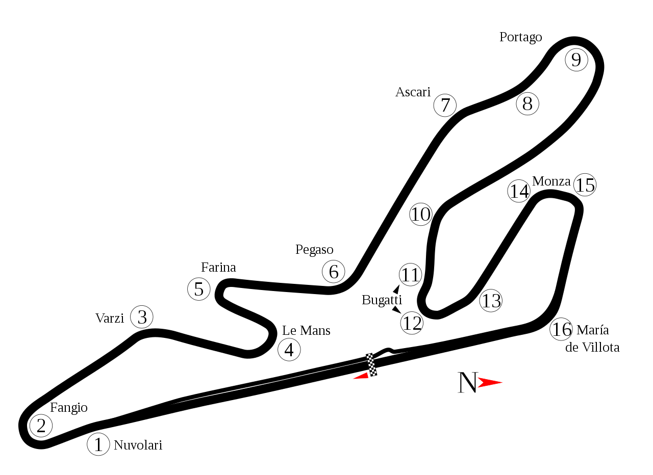
English: Track map of Circuito Permanente del Jarama. Note: The image listed below shows a section of track that doesn't appear in Google Earth. It is possible that section has been removed. |
| 日期 | |
| 來源 | 自己的作品 |
| 作者 | Will Pittenger |
| 其他版本 |
|

| 拍攝地點 | | 位於此地的本圖片與其他圖片: OpenStreetMap |
|---|
授權條款
| 我,此作品的版權所有人,釋出此作品至公共領域。此授權條款在全世界均適用。 這可能在某些國家不合法,如果是的話: 我授予任何人有權利使用此作品於任何用途,除受法律約束外,不受任何限制。 |
檔案歷史
點選日期/時間以檢視該時間的檔案版本。
| 日期/時間 | 縮圖 | 尺寸 | 使用者 | 備註 | |
|---|---|---|---|---|---|
| 目前 | 2021年9月9日 (四) 19:30 | | 1,312 × 955(34 KB) | Guadarrama1913 | 2017 update + minor changes |
| 2013年9月30日 (一) 10:56 |  | 1,312 × 955(31 KB) | Sentoan | Mistake at T2 | |
| 2013年9月30日 (一) 10:54 |  | 1,312 × 955(31 KB) | Sentoan | Real dimensions of the track, correct turn names, | |
| 2008年7月18日 (五) 02:43 |  | 1,312 × 955(33 KB) | Will Pittenger | {{Information |Description={{en|1=Track map of w:Circuito Permanente del Jarama. Note: The image listed below shows a section of track that doesn't appear in Google Earth. It is possible that section has been removed.}} |Source=Own work by uploader |
檔案用途
下列頁面有用到此檔案:
全域檔案使用狀況
以下其他 wiki 使用了這個檔案:
- af.wikipedia.org 的使用狀況
- ar.wikipedia.org 的使用狀況
- ast.wikipedia.org 的使用狀況
- bn.wikipedia.org 的使用狀況
- ca.wikipedia.org 的使用狀況
- de.wikipedia.org 的使用狀況
- en.wikipedia.org 的使用狀況
- Circuito del Jarama
- 2006 1000 km of Jarama
- 2001 ELMS at Jarama
- 1991 European motorcycle Grand Prix
- 1993 FIM motorcycle Grand Prix
- 1997 International Sports Racing Series Jarama
- 2002 FIA GT Jarama 500km
- 2001 FIA GT Jarama 500km
- 1996 BPR 4 Hours of Jarama
- List of Superbike World Championship circuits
- User talk:Chubbennaitor/archive2
- European motorcycle Grand Prix
- User talk:Barkjon/Archive 2
- Wikipedia:WikiProject Formula One/Newsletter/200808
- User talk:Hellboy2hell/archive2
- User talk:NapHit/Archive 1
- User talk:4u1e/archive5
- List of Grand Prix motorcycle circuits
- User talk:Typ932/Archive 3
- User talk:Midgrid/Archive 6
- 1998 Madrid motorcycle Grand Prix
- User talk:Thelb4/Archive 5
- User talk:Chubbennaitor/Archive7
- User talk:Readro/Archive 3
- User talk:Donnie Park/Archive 1
- User talk:The359/Archive 4
- List of Superleague Formula circuits
- 2009 Jarama Superleague Formula round
- List of American Le Mans Series circuits
- List of European Le Mans Series circuits
- User talk:Cs-wolves/Archive 3
- User talk:Bam123456789/Archive 1
- 2010 Jarama Superleague Formula round
- 1000 km Jarama
- User talk:Sage Callahan/Archive 1
- User talk:Cdhaptomos/Archive 1
- User talk:Spenalzo/Archive/2008
- User talk:Clyde1998/Archive/2008
檢視此檔案的更多全域使用狀況。