File:SyltSat.jpg
本预览的尺寸:445 × 600像素。 其他分辨率:178 × 240像素 | 356 × 480像素 | 668 × 900像素。
原始文件 (668 × 900像素,文件大小:40 KB,MIME类型:image/jpeg)
摘要
| 描述 |
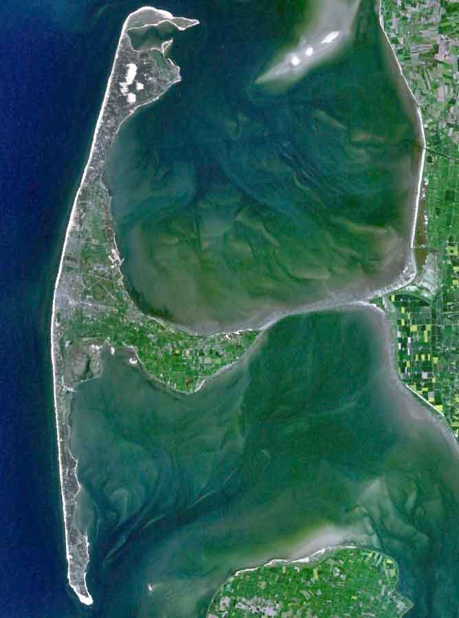
English: The Island of Sylt in Northern Germany from the South. Satellite view. |
| 日期 | 2005年4月24日 (上传日期) |
| 来源 | Satellite imagery taken from NASA World Wind software (by screenshot) |
| 作者 | NASA |
许可协议
| 本图像属于 w:公有领域 ,因其为 NASA 的 World Wind 卫星地图浏览器的一张截图,且使用了公有领域图层,如 Blue Marble、MODIS、Landsat、SRTM、USGS、GLOBE 等。
|
 |
| 注解 | 该图片含有注解:在维基媒体共享资源上查看注解 |
文件历史
点击某个日期/时间查看对应时刻的文件。
| 日期/时间 | 缩略图 | 大小 | 用户 | 备注 | |
|---|---|---|---|---|---|
| 当前 | 2006年8月4日 (五) 19:39 | | 668 × 900(40 KB) | Ollio | original work of NASA - public domain picture made brigther by O. Lippuner (User --~~~~), without changing public domain status |
| 2005年4月24日 (日) 14:01 |  | 668 × 900(350 KB) | SeballaOne~commonswiki | The Island of Sylt in Northern Germany from the South. Created with World Wind {{PD-USGov-NASA}} Category:Islands Category:Satellite photos |
文件用途
以下页面使用本文件:
全域文件用途
以下其他wiki使用此文件:
- af.wikipedia.org上的用途
- ar.wikipedia.org上的用途
- br.wikipedia.org上的用途
- ca.wikipedia.org上的用途
- da.wikipedia.org上的用途
- de.wikipedia.org上的用途
- en.wikipedia.org上的用途
- eo.wikipedia.org上的用途
- es.wikipedia.org上的用途
- fa.wikipedia.org上的用途
- frr.wikipedia.org上的用途
- fr.wikipedia.org上的用途
- fy.wikipedia.org上的用途
- is.wikipedia.org上的用途
- it.wikipedia.org上的用途
- ko.wikipedia.org上的用途
- ksh.wikipedia.org上的用途
- mk.wikipedia.org上的用途
- nds.wikipedia.org上的用途
- nn.wikipedia.org上的用途
- no.wikipedia.org上的用途
- pnb.wikipedia.org上的用途
- pt.wikipedia.org上的用途
- stq.wikipedia.org上的用途
- sv.wikipedia.org上的用途
- xmf.wikipedia.org上的用途