File:U.S. Territorial Acquisitions-zh-classical.png

本预览的尺寸:776 × 600像素。 其他分辨率:311 × 240像素 | 621 × 480像素 | 994 × 768像素 | 1,280 × 989像素 | 2,560 × 1,978像素 | 3,960 × 3,060像素。
原始文件 (3,960 × 3,060像素,文件大小:2.49 MB,MIME类型:image/png)
| 描述 |
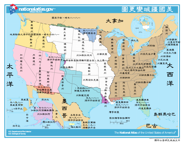
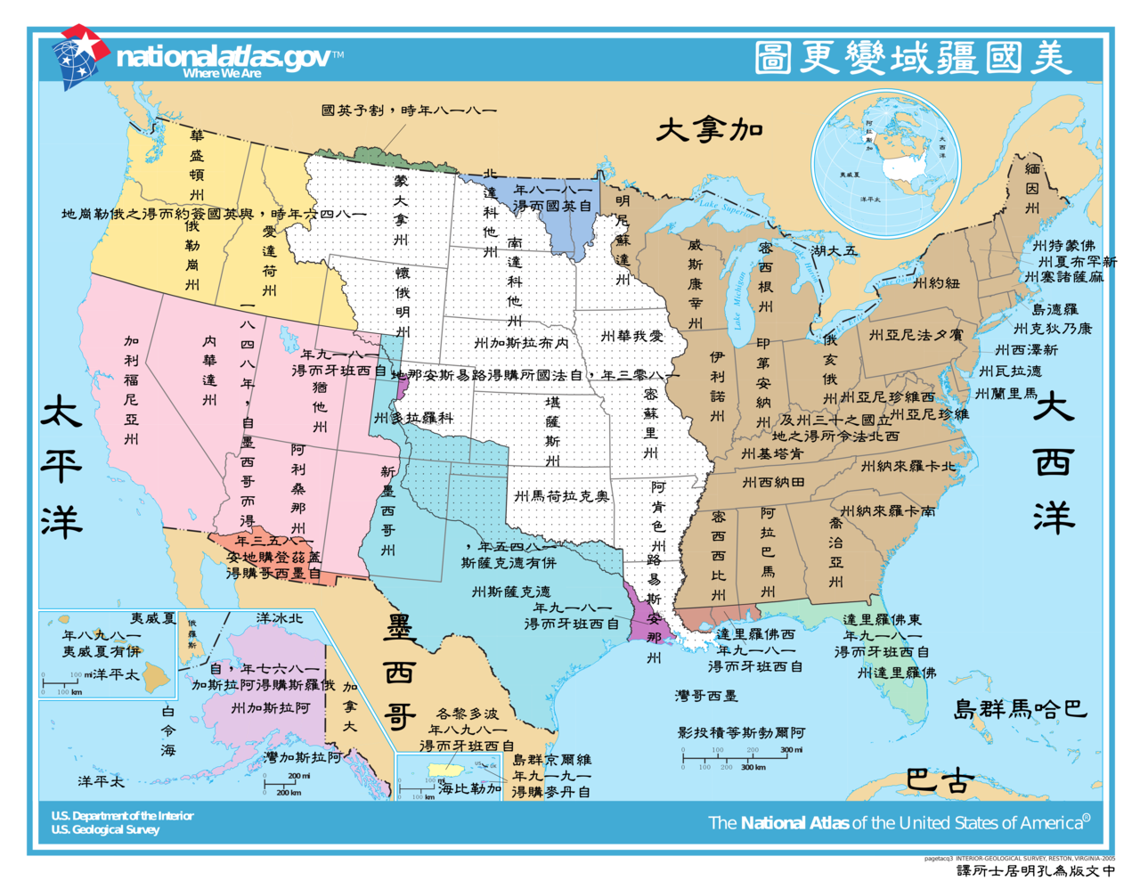
This image depicts the Territorial acquisitions of the United States, such as the Thirteen Colonies, the Louisiana Purchase, British and Spanish Cession, and so on. ErrorsThis map uses incorrect terms in that Great Britain didn't exist as a political entity in 1818 or 1846, having been superseded by the United Kingdom following the Act of Union with Ireland in 1801. This map does not show the full extent of the Oregon Territory into what is now Canada. The map shows a portion of the en:Isle of Orleans as part of the West Florida (Spanish Cession) 1819, but the area south of Lake Pontchartrain and east of the Amite River were part of the Louisiana Purchase 1803 (from France). |
|||
| 来源 | National Atlas of the United States [1] | |||
| 作者 | United States federal government (The Classical Chinese Translation is made by User:Itsmine.) | |||
| 授权 (二次使用本文件) |
|
|||
| 其他版本 | English Version: Image:U.S. Territorial Acquisitions.png |
文件历史
点击某个日期/时间查看对应时刻的文件。
| 日期/时间 | 缩略图 | 大小 | 用户 | 备注 | |
|---|---|---|---|---|---|
| 当前 | 2008年3月2日 (日) 10:51 | | 3,960 × 3,060(2.49 MB) | Itsmine | |
| 2008年3月2日 (日) 09:39 |  | 3,960 × 3,060(2.5 MB) | Itsmine | {{Information| |Description= This image depicts the Territorial acquisitions of the United States, such as the Thirteen Colonies, the Louisiana Purchase, British and Spanish Cession, and so on. === Er |
文件用途
全域文件用途
以下其他wiki使用此文件:
- zh-classical.wikipedia.org上的用途