File:First Czechoslovak Republic.SVG

此SVG文件的PNG预览的大小:800 × 377像素。 其他分辨率:320 × 151像素 | 640 × 302像素 | 1,024 × 483像素 | 1,280 × 604像素 | 2,560 × 1,207像素 | 1,001 × 472像素。
原始文件 (SVG文件,尺寸为1,001 × 472像素,文件大小:69 KB)
| 描述 |
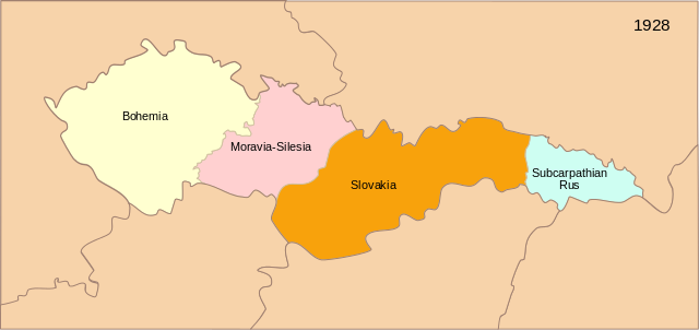
[] Deutsch: Karte der Tschechoslowakischen Republik (1928) English: Map of the First Czechoslovak Republic after 1928 Español: Mapa de la Primera República de Checoslovaquia tras los cambios de administración territorial de 1928 Français : Carte de la Première République tchécoslovaque aprés 1928 Magyar: Az első Csehszlovák Köztársaság 1928-ban Svenska: Karta över den första tjeckoslovakiska republiken efter 1928 Українська: Карта Першої Чехословацької Республіки після 1928 |
| 日期 | (UTC) |
| 来源 | |
| 作者 | 16:36, 13 September 2007 (UTC) |
| 其他版本 |
[]
|


|
This SVG file contains embedded text that can be translated into your language, using any capable SVG editor, text editor or the SVG Translate tool. For more information see: About translating SVG files. |
| 这是一张修改过的图片,这意味着它已在原版本的基础上通过软件进行了编辑。其原始版本为:Blank map of Europe - Atelier graphique colors.svg。修改者:Themightyquill。
|
本文件采用知识共享署名-相同方式共享 3.0 未本地化版本许可协议授权。
- 您可以自由地:
- 共享 – 复制、发行并传播本作品
- 修改 – 改编作品
- 惟须遵守下列条件:
- 署名 – 您必须对作品进行署名,提供授权条款的链接,并说明是否对原始内容进行了更改。您可以用任何合理的方式来署名,但不得以任何方式表明许可人认可您或您的使用。
- 相同方式共享 – 如果您再混合、转换或者基于本作品进行创作,您必须以与原先许可协议相同或相兼容的许可协议分发您贡献的作品。
原始上传日志
This image is a derivative work of the following images:
- Image:Czechoslovakia01.png licensed with PD-self
- 2006-12-28T16:11:35Z Electionworld 1100x497 (92110 Bytes) {{ew|en|PANONIAN}} Map of {{link|Czechoslovakia}} (self made) Note: The provinces shown on the map were introduced by Act No. 125/1927 Zb. and became effective in 1928. {{PD-self}} [[Category:Maps of Czechoslovakia]] [[Cat
- Image:Blank_map_of_Europe_-_Atelier_graphique_colors.svg licensed with Cc-by-sa-2.5,2.0,1.0, GFDL
- 2007-09-16T15:08:27Z Historicair 841x731 (495651 Bytes) '
- 2007-09-13T16:36:42Z Historicair 841x731 (495370 Bytes) {{Information |Description={{fr|Carte vierge de l'Europe, couleurs Atelier Graphique}} {{en|Blank map of Europe with Atelier graphique colors}} |Source=[[:Image:Europe countries.svg]] by [[User:Tintazul|Tintazul]] |Date=13/09
Uploaded with derivativeFX
文件历史
点击某个日期/时间查看对应时刻的文件。
| 日期/时间 | 缩略图 | 大小 | 用户 | 备注 | |
|---|---|---|---|---|---|
| 当前 | 2008年6月10日 (二) 13:57 | | 1,001 × 472(69 KB) | Themightyquill | |
| 2008年6月10日 (二) 13:19 |  | 1,001 × 471(72 KB) | Themightyquill | ||
| 2008年6月9日 (一) 22:27 |  | 1,001 × 471(59 KB) | Themightyquill | ||
| 2008年6月9日 (一) 15:42 |  | 1,001 × 471(394 KB) | Themightyquill | ||
| 2008年6月8日 (日) 23:43 |  | 1,001 × 471(67 KB) | Themightyquill | ||
| 2008年6月8日 (日) 23:40 |  | 1,100 × 497(67 KB) | Themightyquill | {{Information |Description={{fr|Carte vierge de l'Europe, couleurs Atelier Graphique}} {{en|Blank map of Europe with Atelier graphique colors}} |Source=*Image:Czechoslovakia01.png *Image:Blank_map_of_Europe_-_Atelier_graphique_colors.svg |Date |
文件用途
以下页面使用本文件:
全域文件用途
以下其他wiki使用此文件:
- ba.wikipedia.org上的用途
- cs.wikipedia.org上的用途
- en.wikipedia.org上的用途
- he.wikipedia.org上的用途
- ru.wikipedia.org上的用途