File:Amazon River 95 km upstream of Tabatinga, Leticia.jpg
本预览的尺寸:800 × 530像素。 其他分辨率:320 × 212像素 | 640 × 424像素 | 1,024 × 678像素 | 1,280 × 848像素 | 3,032 × 2,008像素。
原始文件 (3,032 × 2,008像素,文件大小:1.65 MB,MIME类型:image/jpeg)
摘要
| 描述 |
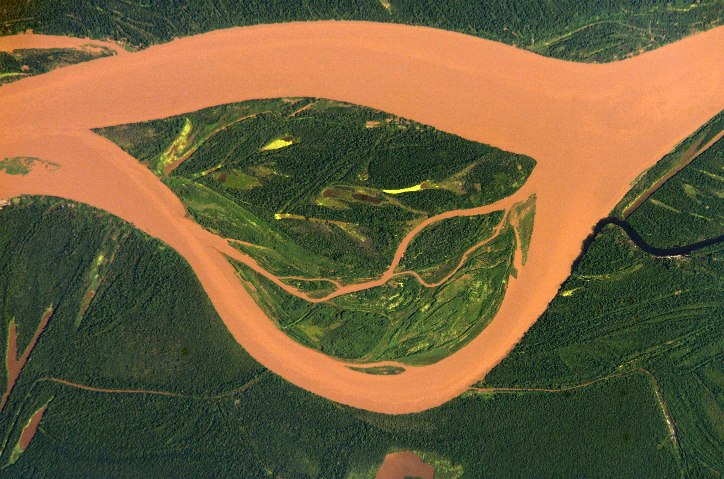
English: Amazon 95 km upstream of Tabatinga/Leticia (Frontier Colombia-Peru)
Deutsch: Amazonas 95 km oberhalb von Tabatinga/Leticia (Grenze Kolumbien-Peru)
Español: Río Amazonas 95 km aguas arriba de Tabatinga/Leticia (Frontera Colombia-Perú) |
| 日期 | |
| 来源 | http://eol.jsc.nasa.gov/scripts/sseop/photo.pl?mission=ISS004&roll=E&frame=12730 |
| 作者 | ISS Expedition 4 crew member |
| 相机位置 | | 在以下服务上查看本图像和附近其他图像: OpenStreetMap |
|---|
本图像或视频收录于美国国家航空航天局 (NASA)休斯顿太空中心(Johnson Space Center),其照片编号是: ISS004-E-12730 此标签不表示文件的著作权状态。任何文件在附有此标签的同時还需要一个有效的著作权标签。请参阅许可协议说明页面以了解更多信息。 其他语言:
|
许可协议
This file is in the public domain in the United States because it was created by the Image Science & Analysis Laboratory, of the NASA Johnson Space Center. NASA copyright policy states that "NASA material is not protected by copyright unless noted". (NASA media use guidelines or Conditions of Use of Astronaut Photographs).
Photo source: ISS004-E-12730.
|
原始上传日志
The original description page was here. All following user names refer to de.wikipedia.
- 2005-03-04 12:14 Managementboy 639×435× (331304 bytes) Guaviare Fluss in Kolumbien
| 注解 | 该图片含有注解:在维基媒体共享资源上查看注解 |
文件历史
点击某个日期/时间查看对应时刻的文件。
| 日期/时间 | 缩略图 | 大小 | 用户 | 备注 | |
|---|---|---|---|---|---|
| 当前 | 2014年7月13日 (日) 14:54 | | 3,032 × 2,008(1.65 MB) | Ras67 | cropped, colors adjusted |
| 2014年7月13日 (日) 14:52 |  | 3,032 × 2,064(1.43 MB) | Ras67 | high resolution original | |
| 2006年4月14日 (五) 19:06 |  | 639 × 422(104 KB) | Darwinek | ||
| 2006年4月14日 (五) 18:52 |  | 639 × 435(324 KB) | Inge-Lyubov~commonswiki | *{{en|Guaviare River in Colombia}} *{{de|Guaviare Fluss in Kolumbien}} *Earth Sciences and Image Analysis, NASA-Johnson Space Center. 30 Apr. 2003. "Astronaut Photography of Earth - Display Record." http://eol.jsc.nasa.gov/scripts/sseop/photo.pl?mission= |
文件用途
以下页面使用本文件:
全域文件用途
以下其他wiki使用此文件:
- azb.wikipedia.org上的用途
- fa.wikipedia.org上的用途
- fr.wikipedia.org上的用途
- it.wikipedia.org上的用途
- lt.wikipedia.org上的用途
- nl.wikipedia.org上的用途
- pl.wikipedia.org上的用途
- pt.wikipedia.org上的用途
- sr.wikipedia.org上的用途
- vi.wikipedia.org上的用途