File:Cornish windsor bridge.jpg
預覽大小:800 × 560 像素。 其他解析度:320 × 224 像素 | 640 × 448 像素 | 1,024 × 717 像素 | 1,280 × 896 像素 | 2,560 × 1,793 像素 | 4,567 × 3,198 像素。
原始檔案 (4,567 × 3,198 像素,檔案大小:1.49 MB,MIME 類型:image/jpeg)
| 拍攝地點 | | 位於此地的本圖片與其他圖片: OpenStreetMap |
|---|
| 描述 |
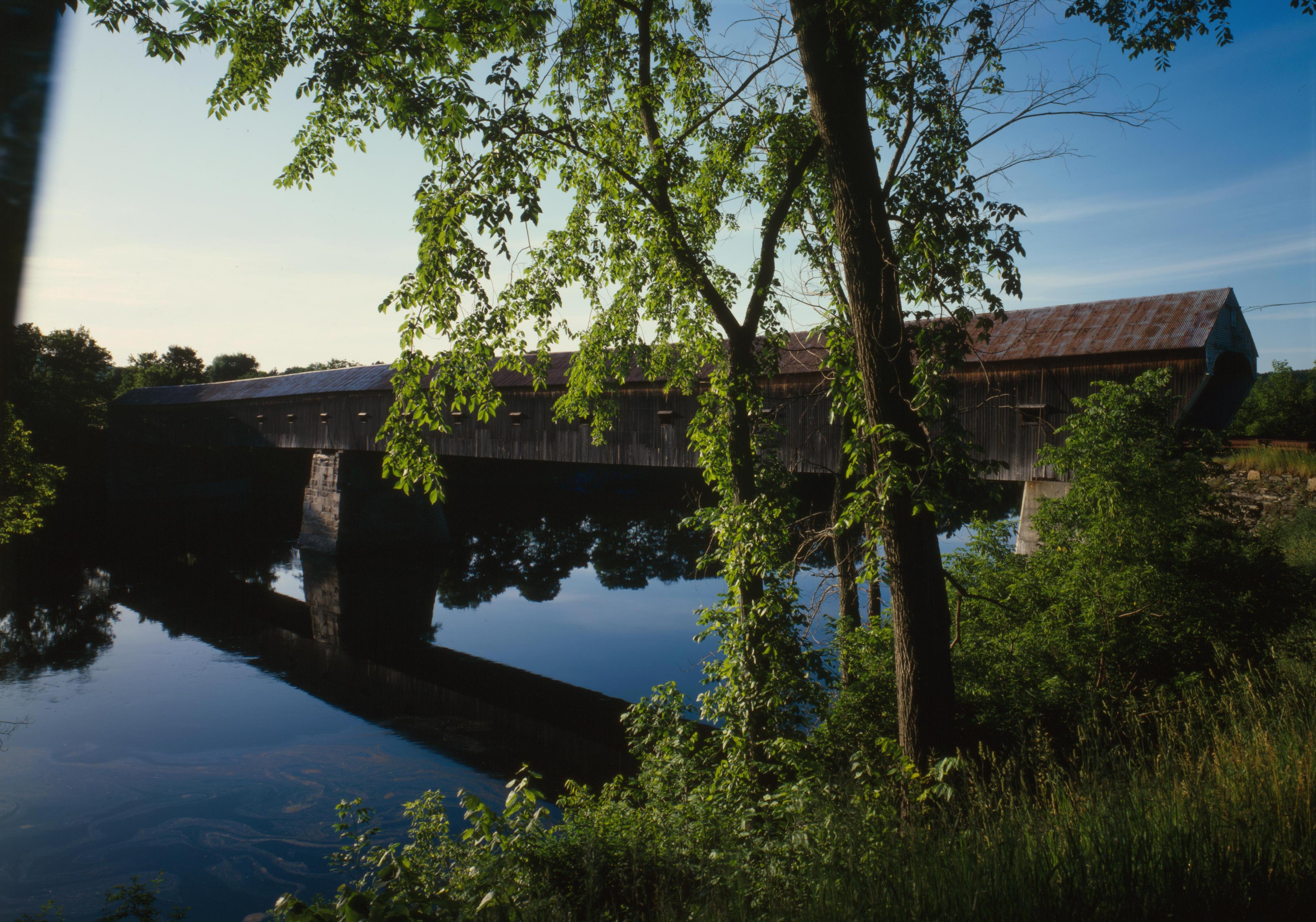
English: Southern (downstream) side of the Cornish-Windsor Covered Bridge, which spans the end of the Zoarville Bridge, which spans the Connecticut River between Cornish, New Hampshire and Windsor, Vermont, in the United States. Built in 1866, it is listed on the National Register of Historic Places. |
||||
| 日期 | |||||
| 來源 | Library of Congress, Prints and Photograph Division HAER: NH,10-CORN,2-11 | ||||
| 作者 | |||||
| 授權許可 (重用此檔案) |
|
.jpg)

|
|
檔案歷史
點選日期/時間以檢視該時間的檔案版本。
| 日期/時間 | 縮圖 | 尺寸 | 用戶 | 備註 | |
|---|---|---|---|---|---|
| 目前 | 2009年9月6日 (日) 17:32 | | 4,567 × 3,198(1.49 MB) | Cropbot | upload cropped version, operated by User:Finavon. Summary: border cropped |
| 2009年8月14日 (五) 05:07 |  | 4,911 × 3,556(1.69 MB) | Nyttend | {{Location|43|28|26|N|72|23|1|W}} {{Information |Description={{en|Southern (downstream) side of the {{w|Cornish-Windsor Covered Bridge}}, which spans the end of the {{w|Zoarville Bridge}}, which spans the {{w|Connecticut River}} between {{w|Cornish, New H |
檔案用途
下列頁面有用到此檔案:
全域檔案使用狀況
以下其他 wiki 使用了這個檔案:
- ar.wikipedia.org 的使用狀況
- de.wikipedia.org 的使用狀況
- en.wikipedia.org 的使用狀況
- Windsor, Vermont
- List of Historic Civil Engineering Landmarks
- National Register of Historic Places listings in Windsor County, Vermont
- Portal:U.S. roads/Did you know
- List of bridges on the National Register of Historic Places in New Hampshire
- List of bridges on the National Register of Historic Places in Vermont
- Portal:U.S. roads/Did you know/October 2011
- User:Eurodog/sandbox153
- es.wikipedia.org 的使用狀況
- fr.wikipedia.org 的使用狀況
- vi.wikipedia.org 的使用狀況