File:Coba Noloch Mull Pano-27527.jpg
預覽大小:800 × 140 像素。 其他解析度:320 × 56 像素 | 640 × 112 像素 | 1,024 × 179 像素 | 1,280 × 224 像素 | 8,000 × 1,400 像素。
原始檔案 (8,000 × 1,400 像素,檔案大小:3.7 MB,MIME 類型:image/jpeg)
摘要
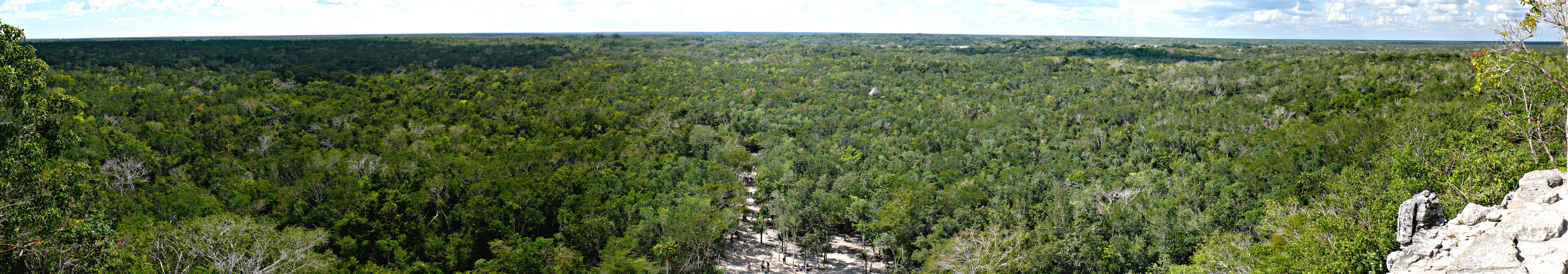
| 描述 | Miles and miles of jungle, as seen from the top of the Mayan Nohoch Mul pyramid on the northen edge of the Cobá archeological site in Quintana Roo, Mexico. Panoramic image compiled with Autostitch from twelve individual photographs, each taken with a Panasonic Lumix DMC-FZ50 mounted to a Panosaurus tripod head. |
| 日期 | 2008年二月1日, 12:15 −06:00 |
| 來源 |
KenThomas.us (personal website of photographer) |
| 作者 | Ken Thomas |
| 授權許可 (重用此檔案) |
This image is released to the public domain, and therefore no permission or credit is required. Comments, feedback and/or questions however, are always welcome. See my user page for contact info. |
| 拍攝地點 | | 位於此地的本圖片與其他圖片: OpenStreetMap |
|---|
授權條款
| 我,此作品的版權所有人,釋出此作品至公共領域。此授權條款在全世界均適用。 這可能在某些國家不合法,如果是的話: 我授予任何人有權利使用此作品於任何用途,除受法律約束外,不受任何限制。 |
檔案歷史
點選日期/時間以檢視該時間的檔案版本。
| 日期/時間 | 縮圖 | 尺寸 | 用戶 | 備註 | |
|---|---|---|---|---|---|
| 目前 | 2008年2月5日 (二) 22:10 | 8,000 × 1,400(3.7 MB) | Ken Thomas | {{Information |Description=Miles and miles of jungle, as seen from the top of the Mayan ''Noloch Mul'' pyramid on the northen edge of the Cobá archeological site in Quintana Roo, Mexico. |
檔案用途
下列頁面有用到此檔案:
全域檔案使用狀況
以下其他 wiki 使用了這個檔案:
- ar.wikipedia.org 的使用狀況
- be.wikipedia.org 的使用狀況
- en.wikipedia.org 的使用狀況
- fr.wikipedia.org 的使用狀況
- ja.wikipedia.org 的使用狀況
- lt.wikipedia.org 的使用狀況