File:Allied shipping at Espiritu Santo on 3 April 1944.jpg
預覽大小:800 × 543 像素。 其他解析度:320 × 217 像素 | 640 × 434 像素 | 1,024 × 695 像素 | 1,280 × 868 像素 | 2,560 × 1,737 像素 | 5,764 × 3,910 像素。
原始檔案 (5,764 × 3,910 像素,檔案大小:16.72 MB,MIME 類型:image/jpeg)
摘要
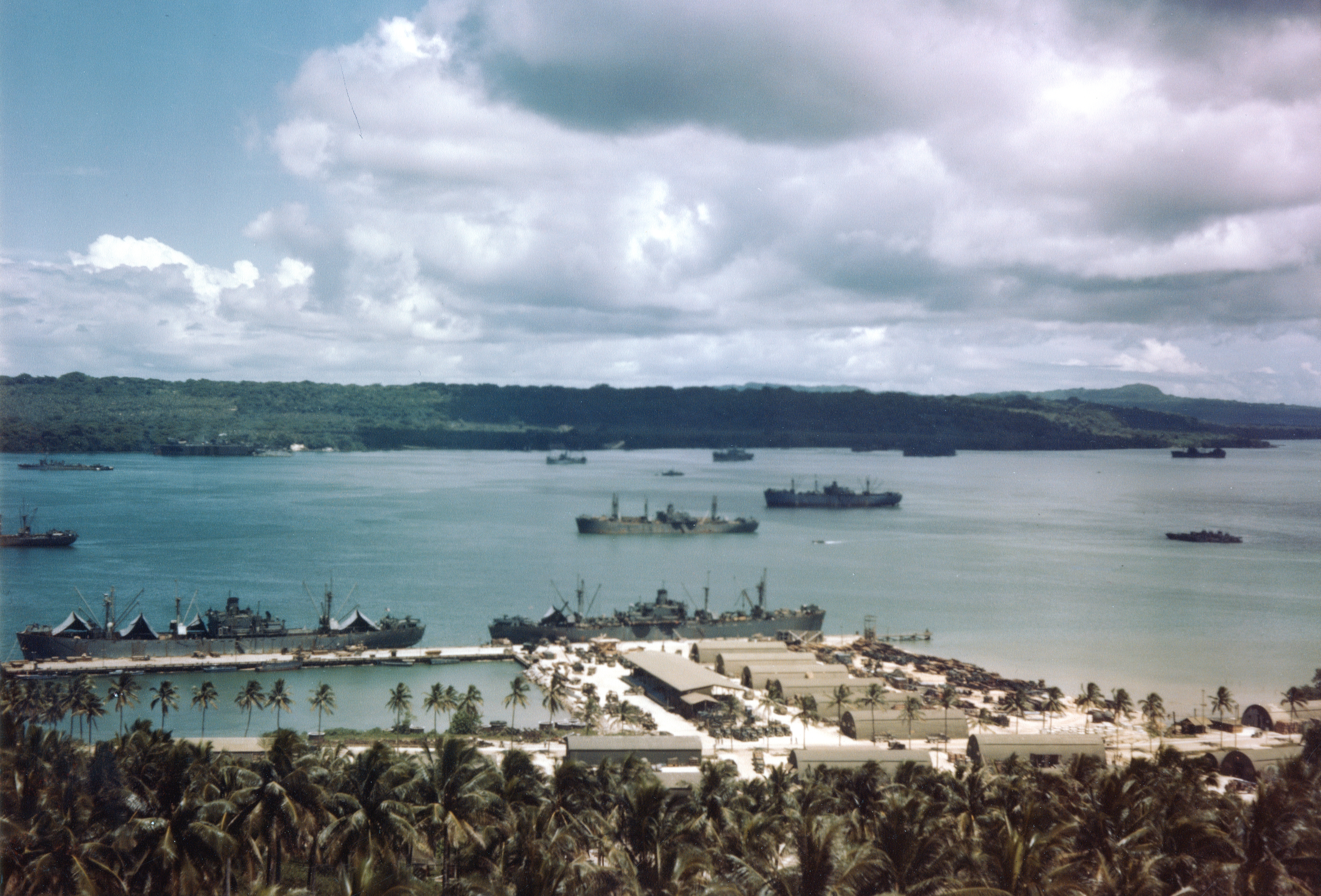
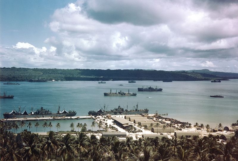
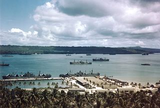
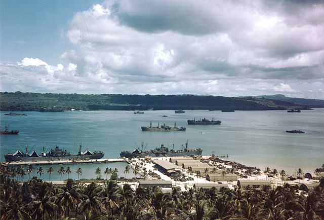
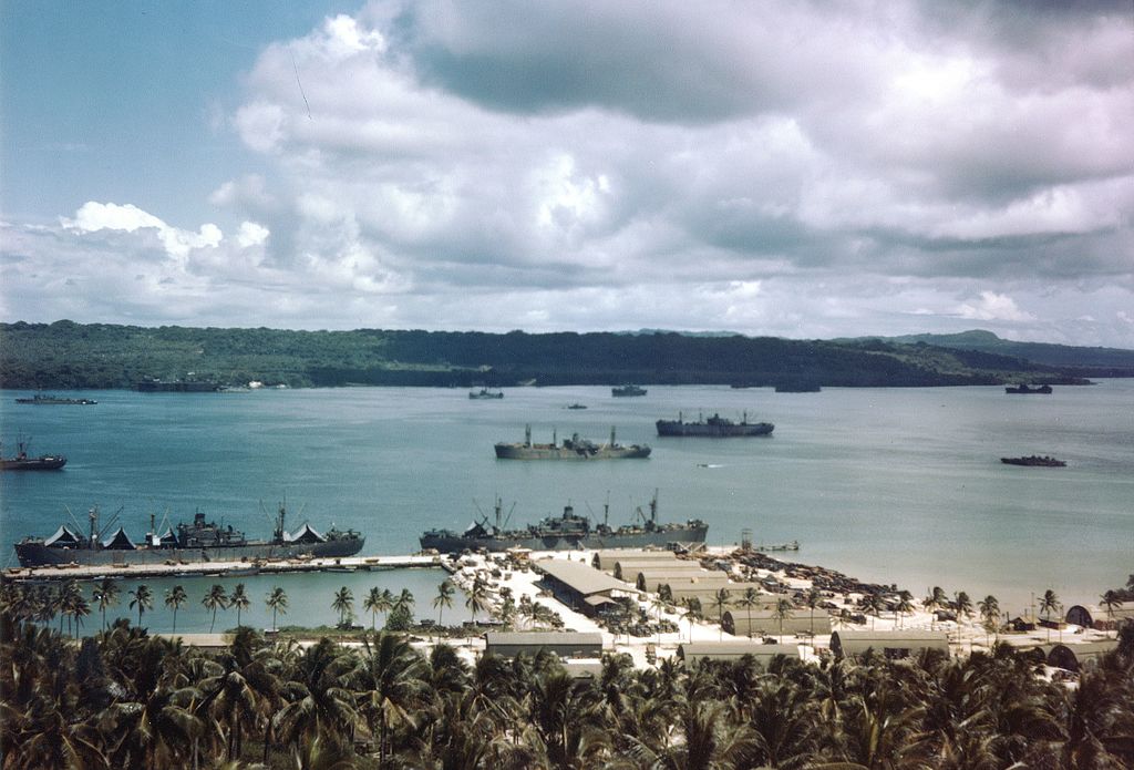
| 描述 | Allied shipping at the naval base dock, and in the channel at Espiritu Santu, New Hebrides, 3 April 1944. Aore and Malo islands are in the background. Numerous Liberty ships are in view. |
| 日期 | |
| 來源 | Official U.S. Navy photo 80-G-K-1996 from the U.S. Navy Naval History and Heritage Command |
| 作者 | U.S. Navy |
| 拍攝地點 | | 位於此地的本圖片與其他圖片: OpenStreetMap |
|---|
授權條款
 | ||
| 此作品無已知的著作權限制,亦不受所有相關和鄰接的權利限制。 | ||
檔案歷史
點選日期/時間以檢視該時間的檔案版本。
| 日期/時間 | 縮圖 | 尺寸 | 用戶 | 備註 | |
|---|---|---|---|---|---|
| 目前 | 2016年3月31日 (四) 15:48 | | 5,764 × 3,910(16.72 MB) | Cobatfor | == {{int:filedesc}} == {{Information |Description= Allied shipping at the naval base dock, and in the channel at Espiritu Santu, New Hebrides, 3 April 1944. Malo Island is in the background. Numerous ''Liberty'' ships are in view. |Source=Official U.S... |
檔案用途
下列頁面有用到此檔案:
全域檔案使用狀況
以下其他 wiki 使用了這個檔案:
- fr.wikipedia.org 的使用狀況