File:Ocean City Maryland aerial view north.jpg
預覽大小:800 × 534 像素。 其他解析度:320 × 214 像素 | 640 × 427 像素 | 1,024 × 683 像素 | 1,500 × 1,001 像素。
原始檔案 (1,500 × 1,001 像素,檔案大小:753 KB,MIME 類型:image/jpeg)
| 描述 |
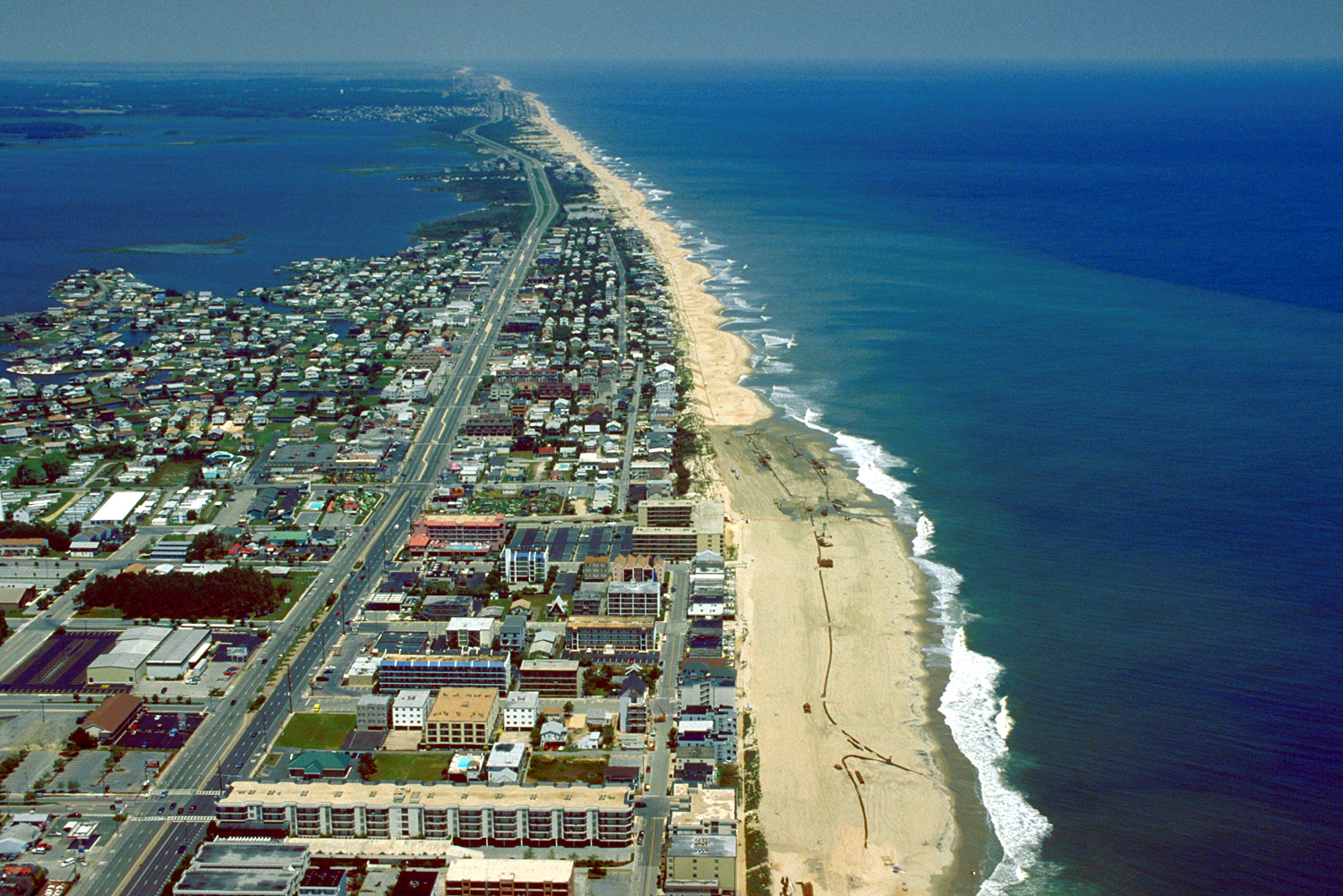
English: Aerial view of Ocean City, Maryland, USA. View is to the north-northeast. |
|||
| 日期 | ||||
| 來源 |
U.S. Army Corps of Engineers Digital Visual Library Image page Image description page Digital Visual Library home page |
|||
| 作者 | Tex Jobe, U.S. Army Corps of Engineers | |||
| 授權許可 (重用此檔案) |
|
|||
| 圖中地點 | Ocean City, Maryland, USA |
| 拍攝地點 | | 位於此地的本圖片與其他圖片: OpenStreetMap |
|---|
檔案歷史
點選日期/時間以檢視該時間的檔案版本。
| 日期/時間 | 縮圖 | 尺寸 | 用戶 | 備註 | |
|---|---|---|---|---|---|
| 目前 | 2007年4月8日 (日) 01:10 | | 1,500 × 1,001(753 KB) | DanMS | {{Information | Description = {{en|Aerial view of Ocean City, Maryland, USA. View is to the north-northeast.}} | Source = U.S. Army Corps of Engineers Digital Visual Library<br />[http://images.usace.army.mil/images/Hires/0454-12.Jpg Image page |
檔案用途
全域檔案使用狀況
以下其他 wiki 使用了這個檔案:
- ar.wikipedia.org 的使用狀況
- bg.wikipedia.org 的使用狀況
- bo.wikipedia.org 的使用狀況
- ca.wikipedia.org 的使用狀況
- de.wikipedia.org 的使用狀況
- en.wikipedia.org 的使用狀況
- es.wikipedia.org 的使用狀況
- fa.wikipedia.org 的使用狀況
- fr.wikipedia.org 的使用狀況
- hak.wikipedia.org 的使用狀況
- hi.wikipedia.org 的使用狀況
- hu.wikipedia.org 的使用狀況
- ilo.wikipedia.org 的使用狀況
- is.wikipedia.org 的使用狀況
- it.wikipedia.org 的使用狀況
- ja.wikipedia.org 的使用狀況
- kn.wikipedia.org 的使用狀況
- pam.wikipedia.org 的使用狀況
- pl.wikipedia.org 的使用狀況
- pt.wikipedia.org 的使用狀況
- tr.wikipedia.org 的使用狀況
- ur.wikipedia.org 的使用狀況