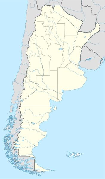
File:Argentina location map.svg

此 SVG 檔案的 PNG 預覽的大小:352 × 599 像素。 其他解析度:141 × 240 像素 | 282 × 480 像素 | 451 × 768 像素 | 602 × 1,024 像素 | 1,204 × 2,048 像素 | 1,418 × 2,412 像素。
原始檔案 (SVG 檔案,表面大小:1,418 × 2,412 像素,檔案大小:1.03 MB)
摘要
.svg)
.svg)

|
|
授權條款
我,本作品的著作權持有者,決定用以下授權條款發佈本作品:

|
已授權您依據自由軟體基金會發行的無固定段落、封面文字和封底文字GNU自由文件授權條款1.2版或任意後續版本,對本檔進行複製、傳播和/或修改。該協議的副本列在GNU自由文件授權條款中。 |
此檔案採用共享創意 姓名標示-相同方式分享 3.0 未在地化版本授權條款。
- 您可以自由:
- 分享 – 複製、發佈和傳播本作品
- 重新修改 – 創作演繹作品
- 惟需遵照下列條件:
- 姓名標示 – 您必須指名出正確的製作者,和提供授權條款的連結,以及表示是否有對內容上做出變更。您可以用任何合理的方式來行動,但不得以任何方式表明授權條款是對您許可或是由您所使用。
- 相同方式分享 – 如果您利用本素材進行再混合、轉換或創作,您必須基於如同原先的相同或兼容的條款,來分布您的貢獻成品。
您可以選擇您需要的授權條款。
檔案歷史
點選日期/時間以檢視該時間的檔案版本。
| 日期/時間 | 縮圖 | 尺寸 | 用戶 | 備註 | |
|---|---|---|---|---|---|
| 目前 | 2022年8月11日 (四) 15:26 | | 1,418 × 2,412(1.03 MB) | Janitoalevic | Reverted to version as of 02:18, 25 May 2021 (UTC) |
| 2022年5月9日 (一) 00:27 |  | 1,418 × 2,412(1.51 MB) | Buttons0603 | Reverted to version as of 20:33, 29 January 2021 (UTC) see below | |
| 2021年5月25日 (二) 02:18 |  | 1,418 × 2,412(1.03 MB) | MinervaAustral | Reverted to version as of 03:37, 24 November 2018 (UTC) | |
| 2021年1月29日 (五) 20:33 |  | 1,418 × 2,412(1.51 MB) | Buttons0603 | Reverted to version as of 13:13, 23 November 2018 (UTC) There is already a version with the Falklands in white at File:Argentina location map (+Falkland).svg for when such a map is needed. | |
| 2018年11月24日 (六) 03:37 |  | 1,418 × 2,412(1.03 MB) | Cacen Gymraeg | Reverted to version as of 01:43, 6 November 2017 (UTC). Added claim territories (neutral point of view) | |
| 2018年11月23日 (五) 13:13 |  | 1,418 × 2,412(1.51 MB) | Mr. James Dimsey | Reverted to version as of 23:25, 9 October 2015 (UTC) | |
| 2017年11月6日 (一) 01:43 |  | 1,418 × 2,412(1.03 MB) | Janitoalevic | Added Fontana and Plata Lake. | |
| 2017年11月6日 (一) 01:37 |  | 1,418 × 2,412(1.02 MB) | Janitoalevic | Fixed provincial and international borders. | |
| 2016年3月25日 (五) 21:36 |  | 1,418 × 2,412(997 KB) | Janitoalevic | Added all the Disputed Territories | |
| 2016年3月21日 (一) 19:00 |  | 1,418 × 2,412(994 KB) | Gustavo Girardelli | Detalles. |
.svg)
檔案用途
下列87個頁面有用到此檔案:
- 1916年南美足球錦標賽
- 1921年南美足球锦标赛
- 1925年南美足球锦标赛
- 1929年南美足球錦標賽
- 1937年南美足球錦標賽
- 1946年南美足球錦標賽
- 1959年南美足球錦標賽 (阿根廷)
- 1978年國際足協世界盃
- 1987年美洲國家盃
- 2001年國際足協世界青年錦標賽
- 2011年美洲國家盃
- 2011年至2012年阿根廷足球乙级联赛
- 2018年夏季青年奧林匹克運動會
- 2023年國際足總U-20世界盃
- 乌玛瓦卡旱谷
- 乔治·纽伯里机场
- 伊沙瓜拉斯托
- 伊瓜苏国家公园 (阿根廷)
- 冰川国家公园 (阿根廷)
- 勒·柯布西耶的建筑作品
- 南美洲足球俱樂部列表
- 卡莱塔科尔多瓦
- 原驼龙属
- 啮王龙属
- 國際足協世界盃場館列表
- 圣卡洛斯-德巴里洛切
- 圣洛伦索 (阿根廷)
- 圣米格尔-德图库曼
- 圣胡安 (阿根廷)
- 圣菲 (阿根廷)
- 圣费尔南多机场
- 圣马蒂亚斯湾
- 坦迪爾
- 埃佩昆
- 埃塞萨皮斯塔里尼部长国际机场
- 埃尔卡拉法特
- 埃尔帕洛马机场
- 埃德加多·卡斯特羅州長機場
- 埃爾馬滕
- 塔拉姆佩雅国家公园
- 奧拉瓦里亞機場
- 布兰卡港
- 布宜諾斯艾利斯
- 帕尔德拉斯角
- 帕翁
- 戴罗
- 手洞
- 拉努斯
- 拉斐拉
- 拉普拉塔
- 拉普拉塔机场
- 拉洛贝里亚
- 拉里奧哈 (阿根廷)
- 梅达诺萨角
- 波萨达斯
- 洛马斯-德萨莫拉
- 烏瑪瓦卡
- 特雷利烏
- 瓦尔德斯半岛
- 科尔多瓦 (阿根廷)
- 科尔多瓦耶稣会牧场和街区
- 科连特斯
- 米拉玛机场
- 罗萨里奥
- 聖胡斯托 (聖大非省)
- 胡寧 (布宜諾斯艾利斯省)
- 艾斯塔多島
- 萨尔塔
- 蓬塔德尔加达 (阿根廷)
- 蓬塔洛约拉
- 蓬塔阿尔塔
- 薩斯特雷 (聖大非省)
- 西波列蒂
- 里奧格蘭德 (火地島省)
- 里瓦达维亚海军准将城
- 门多萨
- 阿根廷世界遺產列表
- 馬德林港
- 馬科斯華雷斯
- 马德普拉塔
- User:WesternPacificOcean/1
- User:WesternPacificOcean/2
- User:WesternPacificOcean/3
- User:WesternPacificOcean/4
- User:WesternPacificOcean/6
- Template:Location map Argentina
- Template:阿根廷世界遗产
全域檔案使用狀況
以下其他 wiki 使用了這個檔案:
- af.wikipedia.org 的使用狀況
- Comodoro Rivadavia
- Mar del Plata
- Bariloche
- La Plata
- Villa General Belgrano
- FIFA Sokker-Wêreldbekertoernooi in 1978
- Balcarce
- Sarmiento
- Sjabloon:Liggingkaart Argentinië
- Monserrat, Buenos Aires
- Aconcagua
- Ojos del Salado
- Los Toldos
- Coloradorivier (Argentinië)
- Rawson
- Ministro Pistarini Internasionale Lughawe
- an.wikipedia.org 的使用狀況
- ar.wikipedia.org 的使用狀況
- ast.wikipedia.org 的使用狀況
- Buenos Aires
- Abbott
- Agote (Buenos Aires)
- La Plata
- Partido de La Plata
- Abasto (La Plata)
- Ángel Etcheverry
- Arturo Seguí
- City Bell
- Joaquín Gorina
- José Hernández (Buenos Aires)
- Manuel B. Gonnet
- Ringuelet
- Tolosa (Buenos Aires)
- Villa Elvira
- Ignacio Correas
- El Peligro (La Plata)
- San Carlos (Buenos Aires)
- San Lorenzo (Buenos Aires)
- Ríu de la Plata
- Mendoza (Arxentina)
- Juan Tronconi
檢視此檔案的更多全域使用狀況。