File:125.39255E 38.73470N Port of Nampho.png

預覽大小:800 × 543 像素。 其他解析度:320 × 217 像素 | 640 × 435 像素 | 1,022 × 694 像素。
原始檔案 (1,022 × 694 像素,檔案大小:1.28 MB,MIME 類型:image/png)
| 描述 |
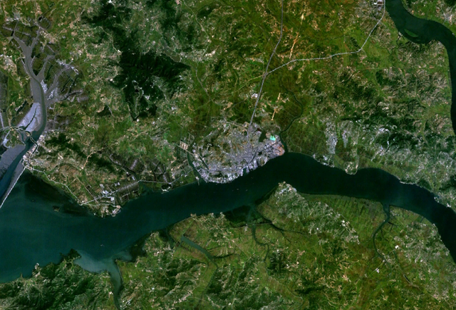
English: Satellite shot showing the port of Nampho, North Korea (the gray mass near the center of the image), from an altitude of 17.5 km. |
|||
| 日期 | date of dataset | |||
| 來源 | Created with NASA WorldWind by User:Oaktree_b using Landsat 7 (Visible Color) satellite image. | |||
| 作者 | NASA | |||
| 授權許可 (重用此檔案) |
|

| 目標地點 | | 位於此地的本圖片與其他圖片: OpenStreetMap |
|---|
檔案歷史
點選日期/時間以檢視該時間的檔案版本。
| 日期/時間 | 縮圖 | 尺寸 | 使用者 | 備註 | |
|---|---|---|---|---|---|
| 目前 | 2011年7月25日 (一) 02:55 | | 1,022 × 694(1.28 MB) | Oaktree b | {{Information |Description ={{en|1=Satellite shot showing the port of Nampho, North Korea (the gray mass near the center of the image), from an altitude of 17.5 km. }} |Source =Created with NASA WorldWind by User:Oaktree_b using Landsat 7 ( |
檔案用途
下列頁面有用到此檔案:
全域檔案使用狀況
以下其他 wiki 使用了這個檔案: