File:Tirana Expansion.png
本预览的尺寸:800 × 558像素。 其他分辨率:320 × 223像素 | 640 × 446像素 | 1,024 × 714像素 | 1,407 × 981像素。
原始文件 (1,407 × 981像素,文件大小:350 KB,MIME类型:image/png)
| 描述 |
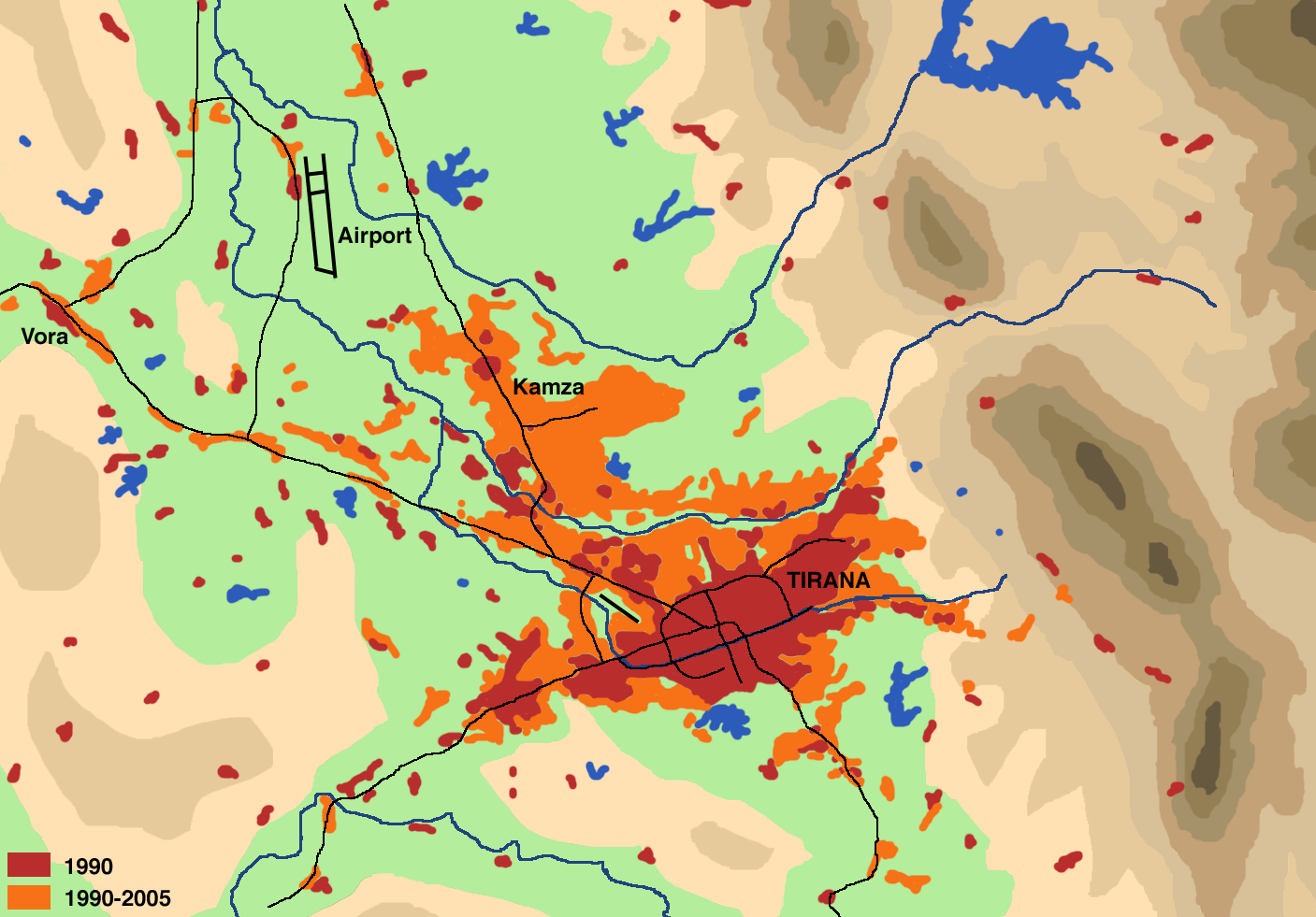
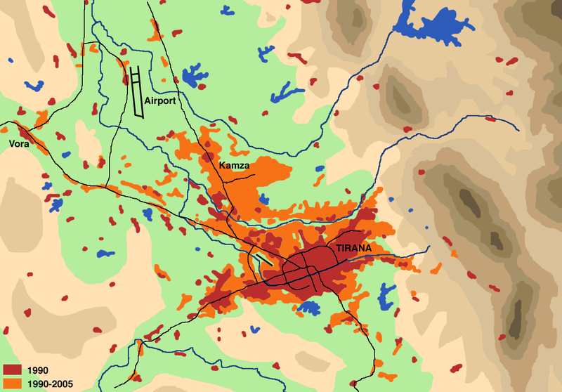
English: Schematical illustration of the population development (settlement area, commercial zones) in the region of Tirana from 1990 to 2005
Deutsch: Schematische Darstellung der Zunahme der Bevölkerungsentwicklung (Siedlungsfläche, Gewerbegebiete) in der Region Tirana zwischen 1990 und 2005 |
| 日期 | |
| 来源 |
Drawn by myself on the basis of
Literature:
|
| 作者 | User:Albinfo |
| 授权 (二次使用本文件) |
我,本作品著作权人,特此采用以下许可协议发表本作品: 本文件采用知识共享署名-相同方式共享 2.5 通用许可协议授权。
|
文件历史
点击某个日期/时间查看对应时刻的文件。
| 日期/时间 | 缩略图 | 大小 | 用户 | 备注 | |
|---|---|---|---|---|---|
| 当前 | 2007年5月6日 (日) 19:30 | | 1,407 × 981(350 KB) | Albinfo | {{Information |Description={{en|Schematical illustration of the population development (settlement area, commercial zones) in the region of Tirana from 1990 to 2005}} {{de|Schematische Darstellung der Zunahme der Bevölkerungsentwicklung (Siedlungsfl� |
文件用途
以下页面使用本文件:
全域文件用途
以下其他wiki使用此文件:
- cs.wikipedia.org上的用途
- de.wikipedia.org上的用途
- el.wikipedia.org上的用途
- el.wikivoyage.org上的用途
- en.wikipedia.org上的用途
- es.wikipedia.org上的用途
- fy.wikipedia.org上的用途
- hy.wikipedia.org上的用途
- incubator.wikimedia.org上的用途
- it.wikipedia.org上的用途
- nl.wikipedia.org上的用途
- pa.wikipedia.org上的用途
- pl.wikipedia.org上的用途
- pt.wikipedia.org上的用途
- sco.wikipedia.org上的用途
- sq.wikipedia.org上的用途
- sv.wikipedia.org上的用途
- ur.wikipedia.org上的用途
- www.wikidata.org上的用途