File:NetherlandsNewGuinea-1916.jpg

原始文件 (3,000 × 1,895像素,文件大小:6.3 MB,MIME类型:image/jpeg)
摘要

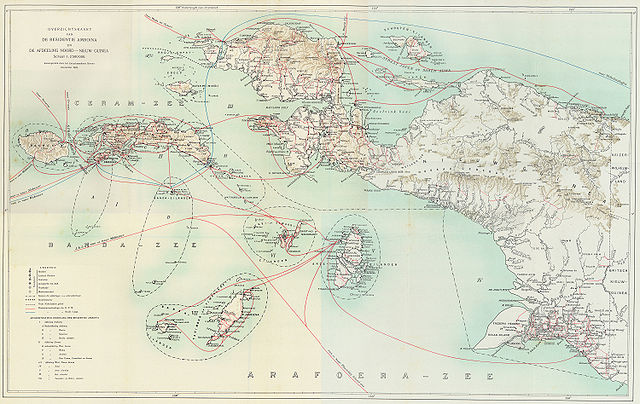
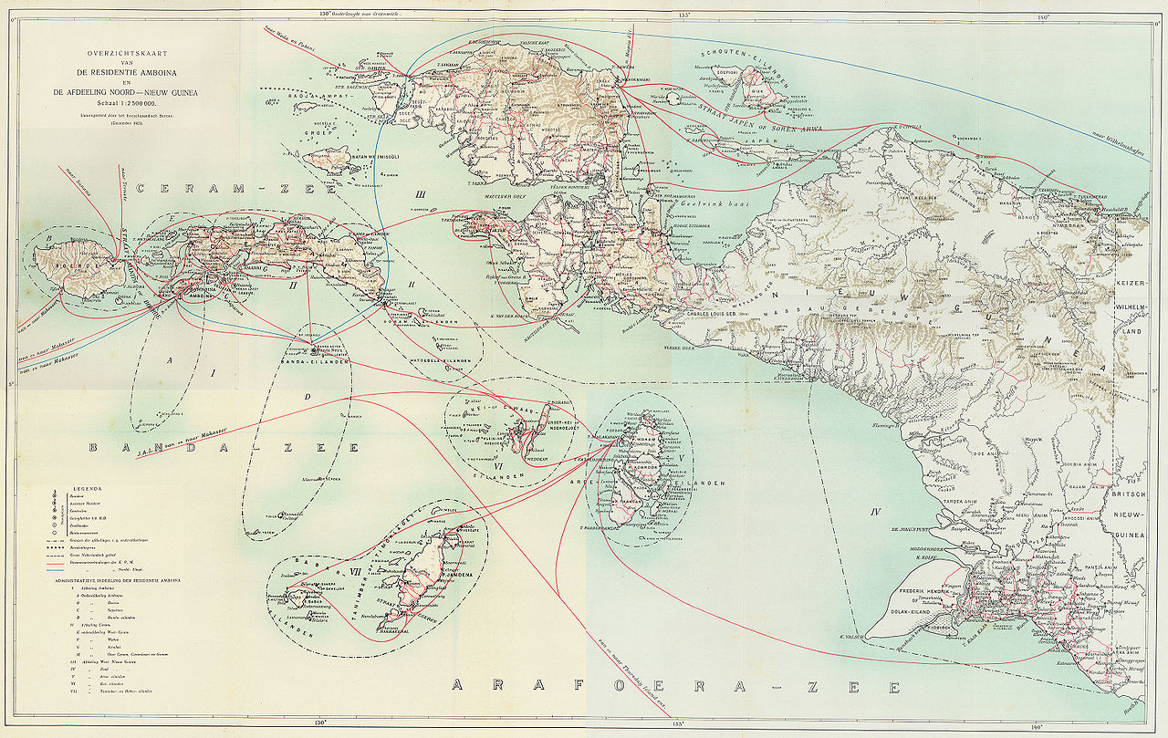
Steamboat connections in Netherlands New Guinea (1915)
This map, published in 1915, is an overview of steamboat connections in the Western New Guinea region. The image was published in Batavia (now Jakarta, Indonesia) in what was then known as the Dutch East Indies. The map is published by a company called G. Kolff & Co and uploaded by PapuaWeb.org archive copy at the Wayback Machine on the Maps of Papua archive copy at the Wayback Machine page. As per the Netherlands Copyright Act of 1912 archive copy at the Wayback Machine, which applies to works published in the Dutch East Indies (Article 47a), the copyright has expired on 1 January 1986 because only the publishing company, not the author, is known (Article 38).
From en:Image:NetherlandsNewGuinea-1916.jpg by en:User:Arsonal
许可协议
|
本作品在其来源国以及其他著作权期限是作者逝世后70年或以下的国家和地区属于公有领域。
| |
| 本文件已被确认为免除已知的著作权法限制(包括所有相关权利)。 | |
文件历史
点击某个日期/时间查看对应时刻的文件。
| 日期/时间 | 缩略图 | 大小 | 用户 | 备注 | |
|---|---|---|---|---|---|
| 当前 | 2006年7月6日 (四) 21:52 | | 3,000 × 1,895(6.3 MB) | Hardscarf | == Summary == === Military Expeditions to Nederlands Nieuw-Guinea 1907-1915 === This map published in 1916 is a documentation of Dutch military expeditions to the Western New Guinea region. The image was published in Batavia (now Jakarta, Indonesia) in |
文件用途
全域文件用途
以下其他wiki使用此文件:
- ar.wikipedia.org上的用途
- arz.wikipedia.org上的用途
- ban.wikipedia.org上的用途
- ca.wikipedia.org上的用途
- cs.wikipedia.org上的用途
- de.wikipedia.org上的用途
- en.wikipedia.org上的用途
- eo.wikipedia.org上的用途
- es.wikipedia.org上的用途
- fr.wikipedia.org上的用途
- id.wikipedia.org上的用途
- it.wikipedia.org上的用途
- ja.wikipedia.org上的用途
- ko.wikipedia.org上的用途
- nl.wikipedia.org上的用途
- pam.wikipedia.org上的用途
- pl.wikipedia.org上的用途
- pt.wikipedia.org上的用途
- ru.wikipedia.org上的用途
- sq.wikipedia.org上的用途
- sv.wikipedia.org上的用途
- tr.wikipedia.org上的用途
- www.wikidata.org上的用途
- zea.wikipedia.org上的用途