File:Ladakh-Garhwal-1863.jpg
本预览的尺寸:800 × 581像素。 其他分辨率:320 × 232像素 | 640 × 465像素 | 1,024 × 744像素 | 1,280 × 930像素 | 2,340 × 1,700像素。
原始文件 (2,340 × 1,700像素,文件大小:1.38 MB,MIME类型:image/jpeg)
摘要
| 描述 |
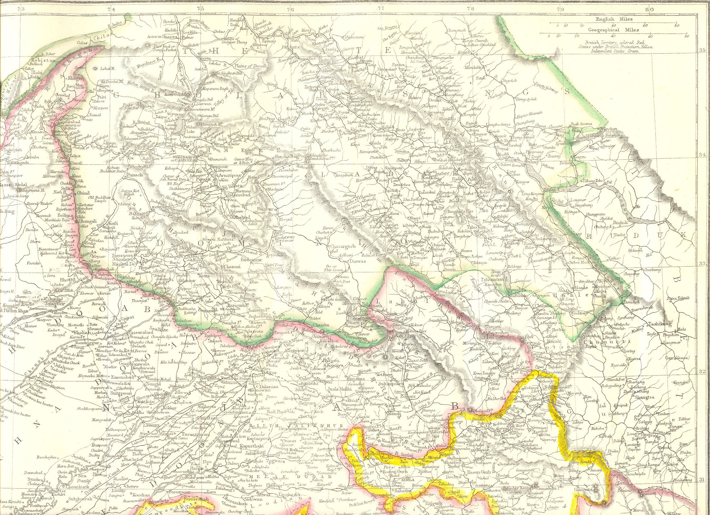
English: Map created by Edward Weller for Weekly Dispatch. South of Changchenmo valley, the borders were those documented by the Kashmir Boundary Commission headed by Alexander Cunningham. They may be compared with the hand-drawn maps made by Henry Strachey, the junior commissioner that actually surveyed the area. |
| 日期 | |
| 来源 | http://www.columbia.edu/itc/mealac/pritchett/00maplinks/colonial/wellermaps/punjab1863/punjab1863.html |
| 作者 | Edward Weller (1819-1884) |
| 其他版本 |
Henry Strachey's map:  |
许可协议
|
本作品在其来源国以及其他著作权期限是作者逝世后70年或以下的国家和地区属于公有领域。 | |
| 本文件已被确认为免除已知的著作权法限制(包括所有相关权利)。 | |
文件历史
点击某个日期/时间查看对应时刻的文件。
| 日期/时间 | 缩略图 | 大小 | 用户 | 备注 | |
|---|---|---|---|---|---|
| 当前 | 2020年5月10日 (日) 16:46 | | 2,340 × 1,700(1.38 MB) | Kautilya3 | Uploaded a work by Edward Weller (1819-1884) from http://www.columbia.edu/itc/mealac/pritchett/00maplinks/colonial/wellermaps/punjab1863/punjab1863.html with UploadWizard |
文件用途
以下页面使用本文件:
全域文件用途
以下其他wiki使用此文件:
- en.wikipedia.org上的用途