File:January 2009 Bay of Biscay storm tracker.png
此为最大尺寸。
January_2009_Bay_of_Biscay_storm_tracker.png (650 × 500像素,文件大小:173 KB,MIME类型:image/png)
摘要
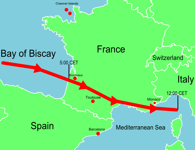
| 描述 | A map of Europe showing the location of the January 2009 Mediterranean storm. The red line shows the track of the storm. |
| 日期 | |
| 来源 | Self-made losely based upon BBC map, but not a derivitive work. |
| 作者 | Jolly Janner |
| 其他版本 | The original vector version |
许可协议
| 我,本作品著作权人,释出本作品至公有领域。这适用于全世界。 在一些国家这可能不合法;如果是这样的话,那么: 我无条件地授予任何人以任何目的使用本作品的权利,除非这些条件是法律规定所必需的。 |
文件历史
点击某个日期/时间查看对应时刻的文件。
| 日期/时间 | 缩略图 | 大小 | 用户 | 备注 | |
|---|---|---|---|---|---|
| 当前 | 2009年1月25日 (日) 14:07 | 650 × 500(173 KB) | Jolly Janner | Added Channel Islands and labeled Switzerland | |
| 2009年1月25日 (日) 01:11 | 650 × 500(163 KB) | Jolly Janner | {{Information |Description=A map of Europe showing the location of the January 2009 Mediterranean storm. The red line shows the track of the storm. |Source=Self-made losely based upon [http://newsimg.bbc.co.u |
文件用途
以下页面使用本文件:
全域文件用途
以下其他wiki使用此文件:
- de.wikinews.org上的用途
- en.wikipedia.org上的用途
- en.wikinews.org上的用途
- es.wikipedia.org上的用途
- eu.wikipedia.org上的用途
- fr.wikipedia.org上的用途
- pl.wikipedia.org上的用途
- pl.wikinews.org上的用途