File:Dunkirk New York aerial view.jpg
本预览的尺寸:800 × 562像素。 其他分辨率:320 × 225像素 | 640 × 449像素 | 1,024 × 719像素 | 1,280 × 899像素 | 1,500 × 1,053像素。
原始文件 (1,500 × 1,053像素,文件大小:703 KB,MIME类型:image/jpeg)
| 描述 |
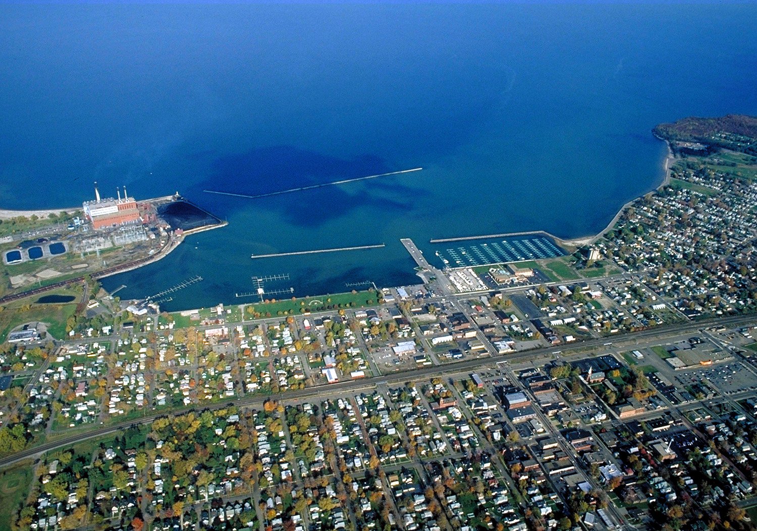
English: Aerial view of Dunkirk, New York, USA. View is to the north over Lake Erie. The large Niagara Mohak power plant can be seen at left. |
|||
| 日期 | ||||
| 来源 |
U.S. Army Corps of Engineers Digital Visual Library Image page Image description page Digital Visual Library home page |
|||
| 作者 | Ken Winters, U.S. Army Corps of Engineers | |||
| 授权 (二次使用本文件) |
|
|||
| 图中地点 | Dunkirk, New York, USA |
| 相机位置 | | 在以下服务上查看本图像和附近其他图像: OpenStreetMap |
|---|
文件历史
点击某个日期/时间查看对应时刻的文件。
| 日期/时间 | 缩略图 | 大小 | 用户 | 备注 | |
|---|---|---|---|---|---|
| 当前 | 2007年3月31日 (六) 06:40 | | 1,500 × 1,053(703 KB) | DanMS | {{Information | Description = {{en|Aerial view of Dunkirk, New York, USA. View is to the north over Lake Erie. The large Niagara Mohak power plant can be seen at left.}} | Source = U.S. Army Corps of Engineers Digital Visual Library<br />[http: |
文件用途
以下页面使用本文件:
全域文件用途
以下其他wiki使用此文件:
- ar.wikipedia.org上的用途
- azb.wikipedia.org上的用途
- ceb.wikipedia.org上的用途
- ce.wikipedia.org上的用途
- cy.wikipedia.org上的用途
- dag.wikipedia.org上的用途
- de.wikipedia.org上的用途
- en.wikipedia.org上的用途
- en.wikivoyage.org上的用途
- es.wikipedia.org上的用途
- eu.wikipedia.org上的用途
- fa.wikipedia.org上的用途
- fr.wikipedia.org上的用途
- ht.wikipedia.org上的用途
- hu.wikipedia.org上的用途
- it.wikipedia.org上的用途
- lld.wikipedia.org上的用途
- pl.wikipedia.org上的用途
- pt.wikipedia.org上的用途
- simple.wikipedia.org上的用途
- sr.wikipedia.org上的用途
- tg.wikipedia.org上的用途
- tr.wikipedia.org上的用途
- tt.wikipedia.org上的用途
- uk.wikipedia.org上的用途
- www.wikidata.org上的用途
- zh-min-nan.wikipedia.org上的用途