File:Cornish windsor bridge.jpg
本预览的尺寸:800 × 560像素。 其他分辨率:320 × 224像素 | 640 × 448像素 | 1,024 × 717像素 | 1,280 × 896像素 | 2,560 × 1,793像素 | 4,567 × 3,198像素。
原始文件 (4,567 × 3,198像素,文件大小:1.49 MB,MIME类型:image/jpeg)
| 相机位置 | | 在以下服务上查看本图像和附近其他图像: OpenStreetMap |
|---|
| 描述 |
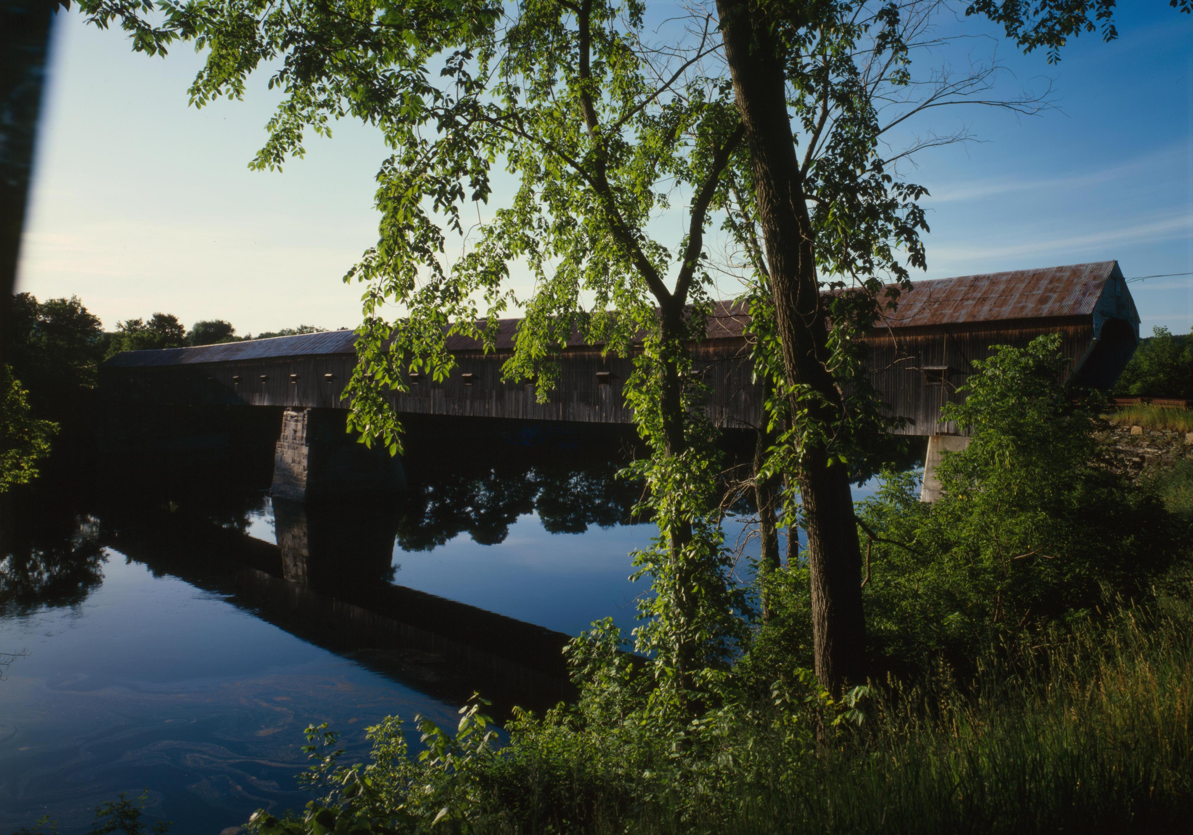
English: Southern (downstream) side of the Cornish-Windsor Covered Bridge, which spans the end of the Zoarville Bridge, which spans the Connecticut River between Cornish, New Hampshire and Windsor, Vermont, in the United States. Built in 1866, it is listed on the National Register of Historic Places. |
||||
| 日期 | |||||
| 来源 | Library of Congress, Prints and Photograph Division HAER: NH,10-CORN,2-11 | ||||
| 作者 | |||||
| 授权 (二次使用本文件) |
|
.jpg)

|
这一图像可以从美国国会图书馆的图片与照片组获得,其编号为hhh.nh0177。
此标签不表示文件的著作权状态。任何文件在附有此标签的同時还需要一个有效的著作权标签。请参阅许可协议说明页面以了解更多信息。
|
文件历史
点击某个日期/时间查看对应时刻的文件。
| 日期/时间 | 缩略图 | 大小 | 用户 | 备注 | |
|---|---|---|---|---|---|
| 当前 | 2009年9月6日 (日) 17:32 | | 4,567 × 3,198(1.49 MB) | Cropbot | upload cropped version, operated by User:Finavon. Summary: border cropped |
| 2009年8月14日 (五) 05:07 |  | 4,911 × 3,556(1.69 MB) | Nyttend | {{Location|43|28|26|N|72|23|1|W}} {{Information |Description={{en|Southern (downstream) side of the {{w|Cornish-Windsor Covered Bridge}}, which spans the end of the {{w|Zoarville Bridge}}, which spans the {{w|Connecticut River}} between {{w|Cornish, New H |
文件用途
以下页面使用本文件:
全域文件用途
以下其他wiki使用此文件:
- ar.wikipedia.org上的用途
- de.wikipedia.org上的用途
- en.wikipedia.org上的用途
- Windsor, Vermont
- List of Historic Civil Engineering Landmarks
- National Register of Historic Places listings in Windsor County, Vermont
- Portal:U.S. roads/Did you know
- List of bridges on the National Register of Historic Places in New Hampshire
- List of bridges on the National Register of Historic Places in Vermont
- Portal:U.S. roads/Did you know/October 2011
- User:Eurodog/sandbox153
- es.wikipedia.org上的用途
- fr.wikipedia.org上的用途
- vi.wikipedia.org上的用途