File:Barra Satellite Photo.png

本预览的尺寸:800 × 564像素。 其他分辨率:320 × 226像素 | 640 × 451像素 | 1,024 × 722像素。
原始文件 (1,024 × 722像素,文件大小:966 KB,MIME类型:image/png)
摘要
| 描述 |
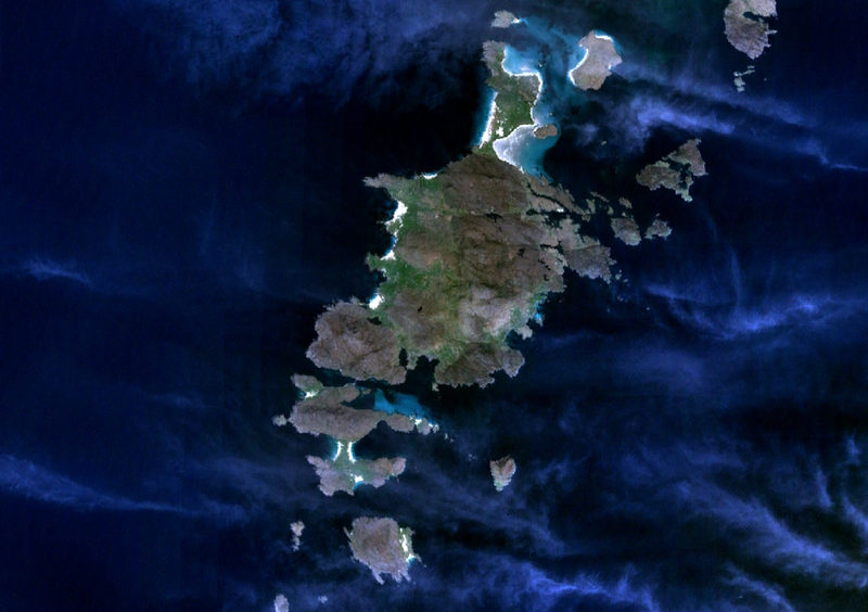
English: Satellite view of Barra surrounded by Vatersay, Sandray to the south, and Hellisay, Gighay and Fuday to the north. |
| 日期 | 2007年1月6日 (上传日期) |
| 来源 | Satellite imagery taken from NASA World Wind software (by screenshot) |
| 作者 | NASA |
许可协议
| 本圖像屬於公有領域,因其為NASA的World Wind衛星地圖瀏覽器的一張截圖,且使用了公有領域圖層,如Blue Marble、MODIS、Landsat、SRTM、USGS、GLOBE等。
|
 |
文件历史
点击某个日期/时间查看对应时刻的文件。
| 日期/时间 | 缩略图 | 大小 | 用户 | 备注 | |
|---|---|---|---|---|---|
| 当前 | 2007年1月6日 (六) 23:42 | | 1,024 × 722(966 KB) | JamesMorrison | Screenrab from NASA World Wind of Barra |
文件用途
以下页面使用本文件:
全域文件用途
以下其他wiki使用此文件:
- br.wikipedia.org上的用途
- el.wikipedia.org上的用途
- en.wikipedia.org上的用途
- es.wikipedia.org上的用途
- eu.wikipedia.org上的用途
- fr.wikipedia.org上的用途
- gd.wikipedia.org上的用途
- hu.wikipedia.org上的用途
- it.wikipedia.org上的用途
- nn.wikipedia.org上的用途
- no.wikipedia.org上的用途
- pl.wikipedia.org上的用途
- ru.wikipedia.org上的用途
- sr.wikipedia.org上的用途
- sv.wikipedia.org上的用途