File:Ancient Khorasan highlighted.jpg
Ancient_Khorasan_highlighted.jpg (373 × 320像素,文件大小:58 KB,MIME类型:image/jpeg)
| 描述 |
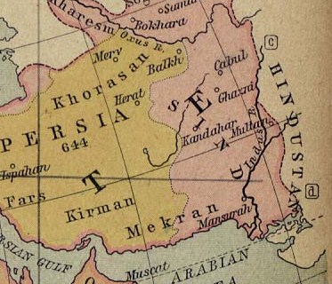
Map showing Ancient Persia in light yellowish and the the land called Sind (most of today's Afghanistan and part of Pakistan) in pinkish. A number of ancient references are made to the names shown in this map. Ibn Batutta writes in 1333 AD: [1]
|
||||
| 日期 | |||||
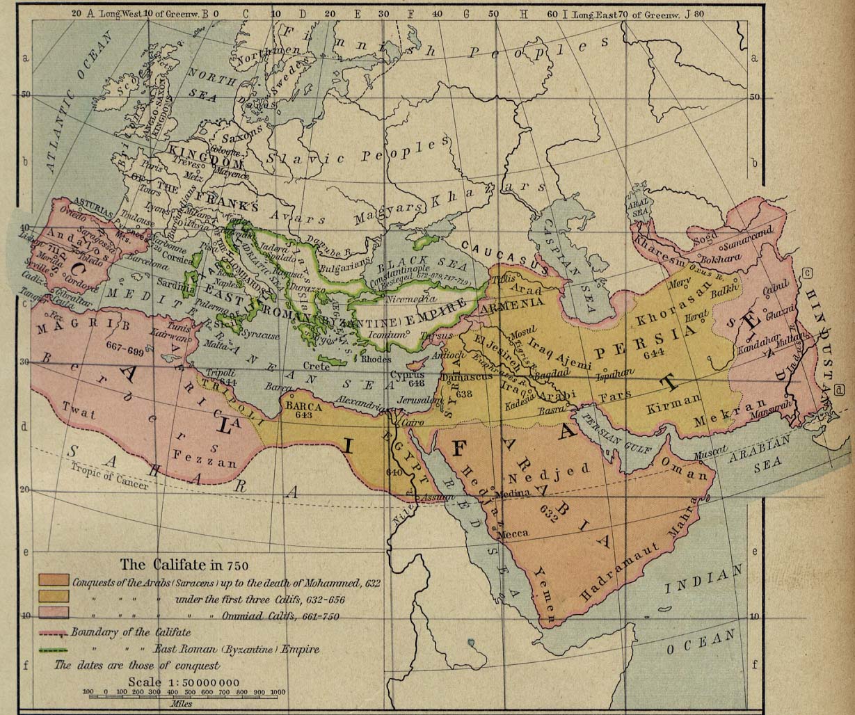
| 来源 | University of Texas at Austin, Middle East and Europe - The Caliphate in 750 (293K) | ||||
| 作者 | William R. Shepherd | ||||
| 授权 (二次使用本文件) |
|
||||
| 其他版本 | full version: File:Califate 750.jpg | ||||
文件历史
点击某个日期/时间查看对应时刻的文件。
| 日期/时间 | 缩略图 | 大小 | 用户 | 备注 | |
|---|---|---|---|---|---|
| 当前 | 2010年10月22日 (五) 19:07 | | 373 × 320(58 KB) | Officer | {{Information |Description= |Source= |Date= |Author= |Permission= |other_versions= }} |
文件用途
以下页面使用本文件:
全域文件用途
以下其他wiki使用此文件:
- an.wikipedia.org上的用途
- ar.wikipedia.org上的用途
- arz.wikipedia.org上的用途
- azb.wikipedia.org上的用途
- ba.wikipedia.org上的用途
- bn.wikipedia.org上的用途
- ca.wikipedia.org上的用途
- ckb.wikipedia.org上的用途
- de.wikipedia.org上的用途
- el.wikipedia.org上的用途
- en.wikipedia.org上的用途
- Muslim conquests of Afghanistan
- History of Afghanistan
- Kabul
- Al-Mansur
- Muslim conquest of Persia
- Greater Khorasan
- Jewish mythology
- History of Arabs in Afghanistan
- Portal:Afghanistan
- Delhi–Multan road
- Talk:Afghanistan/Archive 8
- Siege of Kabul (1504)
- User:Tisquesusa/sandbox9
- User:Falcaorib
- User:Northamerica1000/Portals of the world
- User:HistoryofIran/Greater Khorasan
- List of sieges of Kabul
- en.wiktionary.org上的用途
- eo.wikipedia.org上的用途
- es.wikipedia.org上的用途
- fa.wikipedia.org上的用途
查看本文件的更多全域用途。