File:2009 Euro ElectionMap.png
本预览的尺寸:525 × 599像素。 其他分辨率:210 × 240像素 | 420 × 480像素 | 673 × 768像素 | 1,131 × 1,291像素。
原始文件 (1,131 × 1,291像素,文件大小:32 KB,MIME类型:image/png)
文件历史
点击某个日期/时间查看对应时刻的文件。
| 日期/时间 | 缩略图 | 大小 | 用户 | 备注 | |
|---|---|---|---|---|---|
| 当前 | 2015年6月21日 (日) 12:20 | | 1,131 × 1,291(32 KB) | DrKay | removing brown line on part of Scottish coast |
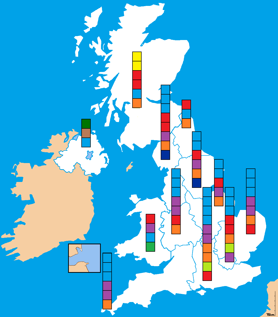
| 2015年4月10日 (五) 15:33 |  | 1,131 × 1,291(32 KB) | DrKay | parties ranked top to bottom in order of vote share per region | |
| 2011年5月28日 (六) 12:08 |  | 1,131 × 1,291(64 KB) | Bastin | Correct NW England (Lib Dem was denominated yellow, which is SNP - not sure they have an MEP south of the border!). | |
| 2010年10月23日 (六) 15:02 |  | 1,131 × 1,291(55 KB) | Mwhite148 | {{Information |Description={{en|1=A map of British constituencies used for the 2009 European Parliament Election. Colours indicate winning party.}} |Source={{own}} |Author=Mwhite148 |Date=2010-10-23 |Permission= |other_versions= }} [[C |
文件用途
没有页面链接到本图像。
全域文件用途
以下其他wiki使用此文件:
- cy.wikipedia.org上的用途
- de.wikipedia.org上的用途
- en.wikipedia.org上的用途
- fa.wikipedia.org上的用途